|
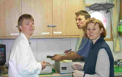
22 April, 1999Today the GEOMAR/Freiberg team deployed their OFOS sled (Ocean Floor Observation System). It is of an entirely different nature than the ZAPS sled. Whereas ZAPS provides instantaneous, real-time chemical content of the seawater around it, OFOS is primarily an optical imaging tool, equipped with a still camera that can either be fired automatically at predetermined intervals or by a remote control from the ship. OFOS also contains a video camera that pipes its video back to the ship via the data/suspension cable. In the control room, an engineer watches the live video of the ocean floor, adjusting the depth off the bottom to maintain a steady 2 meter separation. This is pretty tough to do when you consider you are a mile away, riding up and down on 6 meter wave swells (often greater than this!) and traveling forward at 1 knot over terrain that is by nature not flat (we’re looking for vents and hydrothermal activity, often associated with volcanically active areas - flows, outcroppings, mounds, the works!). I have to hand it to the officers and the engineers, they did an amazing job keeping the camera platform within a few meters of the floor - close enough to see hundreds of brittle stars (like starfish) and a few urchins. To aid in this navigation, the sled is equipped with a weight suspended from 2 meters of line that shows up in the video field. The engineer watches the weight and tries to keep it from crashing into or straying too far from the ocean floor. It really looked like a video game - the engineer was using what looked like a joystick to control the winch speed up and down and watching his progress on the video screen. There are also two lasers on the sled, aimed so that it provides you with a 40-cm reference point by looking at the distance on the ocean floor of the 2 red dots produced. We watched for several hours as the sled made its way over ridges, rises, off cliffs, and into cliffs too! It is a pretty sturdy package and produced some cool video and even more amazing photographs. The GEOMAR/Freiberg people are suggesting that some of the colored patterns that showed up along the path taken may be iron oxy-hydroxide, a possible precipitate from a vent site. Yet more tantalizing clues! I’d like to feature the GEOMAR/Freiberg scientists today in honor of their OFOS’ first deployment of this cruise. First things first - GEOMAR is a research center for marine geology (hence it’s name) out of the University of Kiel in Germany. The team is comprised of Dr. Geraldine Sarthou, a French marine chemist with degrees in engineering, environmental chemistry and marine chemistry from the universities of Bordeaux and Toulouse, France; Anke Daehlmann, with a degree in marine chemistry out of the Technical University of Braunschweig; Sven Petersen, the economic geologist with a degree from Freiberg University of Mining and Technology, Heiko Sahling with a degree in marine biology from the University of Kiel; and Volker Nuppenau, their electronic engineer whose company, OKTOPUS, specializes in deep sea instrumentation, keeps the TV-Grab and the OFOS transmitting data. The team is here to collaborate with the OSU group, being specifically interested in the chemistry of vent fluids and precipitates coming out of this back-arc basin (The earth is covered with solid rock plates called “tectonic plates.” If you think of tectonic plates as the fractured and solidified tops of fresh baked brownies - the top is hard and fractured into flakes that are similar to tectonic plates over the gooey, hot interior. If two of these flakes were to collide, one would slide under the other, or subduct. In the case of the earth, often the rock that goes under will melt and pressure and density cause the molten rock to rise up through the top crust, forming an arc of volcanoes. Sometimes, behind this arc, the plate that rides over the other is being stretched thin. This stretched region is often deep and hot magma can push through. Here in this part of Antarctica, the Bransfield strait is the back-arc, while the South Shetland Islands are the arc volcanoes). I asked each of the GEOMAR team what brought them into oceanography and the answers ranged from Dr. Sarthou’s natural pursuit of a union between her quantitative abilities and her interest in the natural environment; to Sven Petersen’s childhood love of volcanoes, rocks and the ocean; to Anke Daehlmann’s interest in environmental chemistry and an internship at the Alfred Wegener Institute for Polar and Marine Science which she just loved; to Heiko Sahling’s childhood on a small island in the North Sea and his lifelong dream to come to Antarctica. Watching them work at applying their hard earned skills and knowledge to the very practical problem of locating and studying the vent’s chemistry and biology, I couldn’t help but wonder how I could communicate the intense satisfaction I observe, not only in the GEOMAR team, but in the entire scientific party. What can I say or do to share with my students and other readers the incredible value reaped from the diligence and efforts given to their prior studies? Aside from the weather and a Q&A, I will sign off now, Tomorrow I hope to highlight the ZAPS sled and operation as it is scheduled to operate all night long. Regards, Shawn Q: Hi Shawn, I don't suppose you know who Nathaniel Palmer was?? A: Nathaniel Palmer is an American (US), attributed with the first sighting of the Antarctic continent... And a related question: Q: Which ship are you on? Can you tell me? How are you enjoying it? What do you do onboard? Have you been to Palmer Station? How many Antarctic ships are there? A: I am aboard the RV/IB Nathaniel B. Palmer. There are basically 2 or 3 of these Antarctic Research Vessel (RV)/Ice Breakers (IB) from what I hear - the Palmer (which I am aboard), the Gould, and the Polar Sea (a coast guard icebreaker). There is also a supply ship, the Greenwave. These are necessary in the south since we maintain permanent research centers on the Antarctic continent. Maintaining supplies and transportation routes through the ice are critical to operating these stations. Currently, there is a new RV/IB under construction primarily for use in support of Arctic research, the Coast Guard ship Healy. My current schedule has me up all night as an observer for the ZAPS operations (I want to be there when they find the vent!), during which time I do some writing, editing or just running back and forth from the maps to the computer screens, trying to understand what everyone else seems to speak as a natural language! “Temperature-Salinity anomalies,” “Potential temperatures,” “nephels vs. back-scattered light signals,” “Up-casts vs. down-casts.” You get the idea…it’s an entire different world, the world of oceanographical research, with it’s own language, mathematics and techniques. My watchstanding starts at 4 AM, so I make my rounds, recording all the data, saving files, and making sure the computer systems haven’t stalled. Next comes breakfast and then I check my email. Lately it seems that I am turning in around 9 AM and getting up at 1 PM or so. By the time I’m ready to face the world, I go out and look at the scenery before the sun sets (it rises around 7:30 AM and sets around 3:30 PM, each (rise and set) lasting about an hour to complete due to the high latitude and the acute angle which the sun’s apparent path makes with the horizon). Next I read the plan of the day to find out what operation is in progress and go observe or parcticipate in any way that I can or I will go do ping editing. If it is a TV Grab (which means sediment pore water extraction) or helium sampling, I know I’ll be busy for the next 2 hours or so. Dinner comes next and shortly after dinner, the ZAPS is redeployed for the entire night. The routine begins again Palmer Station is a U.S. research station off the peninsula on an island. I probably won't make it to land fall, but its hard to be too disappointed - we're doing some real “way cool” science in the middle of some of the most beautiful landscape I've ever seen - volcanoes exploding vertically out of deep ocean (figuratively!), glaciers spilling down their sides, banks of fog/clouds racing over the water, icebergs that look more like the spaceships in the movie Independence Day drifting around (100 feet high and bigger than several football fields - I saw two like this the other morning, HUGE!). Weather report for today (4/22/99): Depth Lat. (S) Long (W) Date Time Temp Baro Wind /direction salinity (m) deg min deg min gmt (C) mbar m/s - degrees ppt 1112 62 10.9 57 15.3 4/22/99 2251 -0.1 979.8 3 160 34.1
Contact the TEA in the field at . If you cannot connect through your browser, copy the TEA's e-mail address in the "To:" line of your favorite e-mail package. |