|
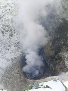
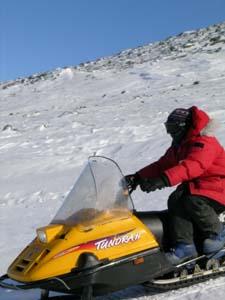
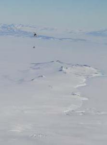
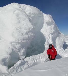
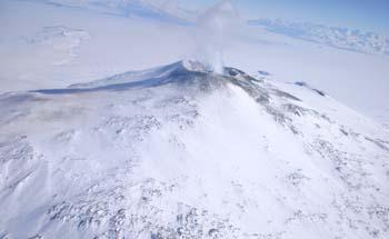
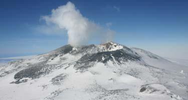
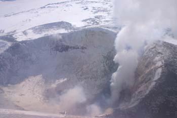
11 December, 2003MacZ This afternoon found us back up on Ray’s Gully again, this time carrying up some of the other instrumentation that will be installed along with the seismometer (see Ray’s Seismic Station). A quick pace on the hike up the gully was required today as we were to meet the helicopter from McMurdo at another station later in the afternoon. Once we reached the top, we stored the equipment in the seismic box and then laid out the cable for the antenna, burying it with rocks as we went. The crater was cloudy today (Figure 1) so there was not much of a view and, as it was getting windier, we didn’t mind heading back down to the Skidoos immediately after the cable was installed (Figure 2). MacZ is another seismic site located about 1,500 feet below the Ray’s station. It is a beautiful overlook for Hut Point Peninsula and McMurdo station. We had a clear view of the helicopter as it reached Castle Rock, a large rocky outcrop between McMurdo and our location. From this distance, the helo was barely visible as a dark speck contrasted by the white snow. As it approached, we could make out its sling load – another large wooden box filled with 70 pound batteries (Figure 3). The helo circled, chose a drop zone, and deposited its load in a flurry of snow kicked up by the propeller wash. Our time at MacZ was brief today as all we had to do was move the battery boxes into position next to the seismic station. Our job quickly accomplished, we had some time to explore on the way home. We stopped at several ice towers (Figure 4) to investigate possible ice caves. Unfortunately, the first cave was too deep to explore without harnesses and ropes, although it remains an intriguing possibility. The second cave proved to be just one small room with a steep, snowy slope. Both were worth the investigation as the wind had dropped and it proved to be a beautiful day. While we were exploring the caves, our helicopter had picked up Dr. Phil Kyle and Dr. Clive Oppenheimer from Lower Erebus Hut. They were sampling gasses directly from the plume today. This vantage point also provided them with some great views of the crater. Flying toward the mountain from the south provides a view of both Erebus and McMurdo station, located at the tip of Hut Point Peninsula (Figure 5). The side crater, Kurt Panter and Brian Winter’s field area (see 12/09/03 The Side Crater), is visible on the southwest flank of Erebus (Figure 6). Finally, a bird’s eye view of the whole crater briefly shows the lava lake through the plume (Figure 7).
Contact the TEA in the field at . If you cannot connect through your browser, copy the TEA's e-mail address in the "To:" line of your favorite e-mail package. |