5 December, 2003
Climbing Fang Ridge
Susan, our FSTP (Field Safety Training Program) mountaineer, took us out
today for a little light hiking up Fang Ridge. It gave us an
opportunity to test out our crampons (metal teeth that strap onto the
bottom of your boots) and ice axes as well as get a little fresh air,
which is the best way to acclimatize. It felt good to stretch our legs
after being cooped up in McMurdo for two weeks. As we headed away from
our little camp, we started to get a sense of how big the Fang Glacier
really is!
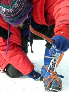
1. Figure 1 – The best way to get acclimatized at high altitude is to do a little light activity. We planned to hike up Fang Ridge. The toughest part of the day? Putting on our crampons.
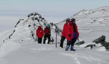
2. Figure 2 – The team hiking up along the Fang ridgeline. Our camp is below us on the right side of the photo. To the left is the ocean.
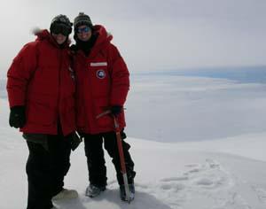
3. Figure 3 – Shauna and I enjoy the view from Fang Ridge. Behind us lies B-15, the massive iceberg that has been in the news lately.
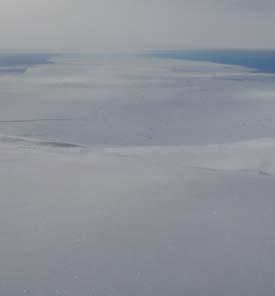
4. Figure 4 – The two sections of B-15 can be seen here. The bottom half of the photo is the seasonal ice shelf and the top two sections are B-15A and B-15J.
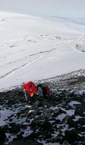
5. Figure 5 – Kurt and Brian work their way up a rocky outcrop of the Fang Ridge. Traveling on solid rock and scree (loose rock) in crampons is a little more challenging as you need to choose your steps carefully.
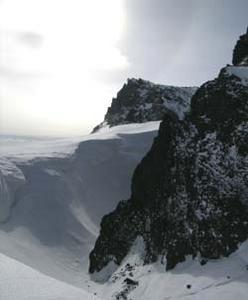
6. Figure 6 – Wind erosion has carved out a “wind scoop” between the glacier and the Fang Ridge.
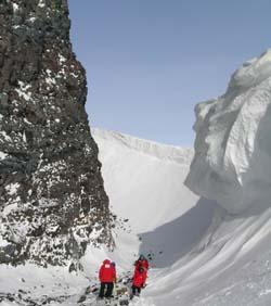
7. Figure 7 – We climbed half way down into the “wind scoop” to look at the overhanging ice and inspect some little ice caves.
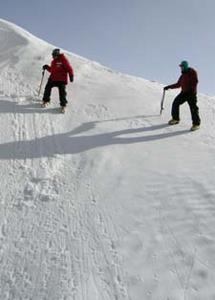
8. Figure 8 – Susan, our mountaineer, taught us to use our crampons and ice axes to traverse steep, icy slopes.
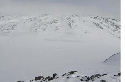
9. Figure 9 – Looking back at our camp from the top of the Fang Ridge, I realized how large the Fang Glacier really is. The three tiny dots in the center of the photo are our Scott tents (which stand head high). Looking at camp from this angle imparted a sense of isolation to our little band of six.
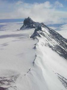
10. Figure 10 – This is an aerial view of the Fang Ridge. The ridge is part of the old caldera of Mt. Erebus. Glacial erosion has carved a valley between Fang Ridge and the current crater rim. Mt. Erebus lies to the left of this photograph while the ocean is to the right. Our camp is not visible. It lies on the flat valley left of the photo. The wind scoop we visited is visible just above the center of the photo on the left side of the ridge. In all, our travels up and along the Fang Ridge lasted for 5 hours. The beauty of working in Antarctica is that the sun never sets, so you can hike late into the night. As much as we enjoyed our walk this evening, we were exhausted by the end of it and looked forward to a hot dinner and warm sleeping bags. As long as this beautiful weather holds, we should have a helicopter flight up to the Lower Erebus Hut, our main field camp, tomorrow morning and then the work begins!
Contact the TEA in the field at
.
If you cannot connect through your browser, copy the
TEA's e-mail address in the "To:" line of
your favorite e-mail package.
|


