|
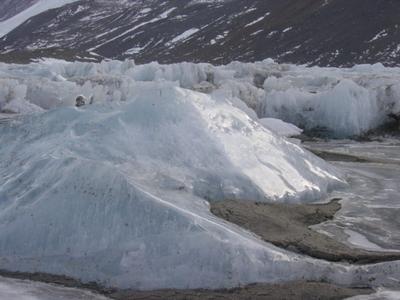
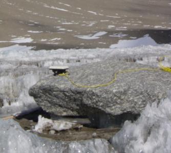
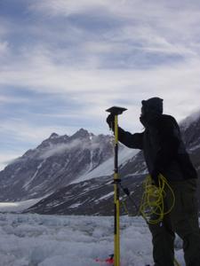
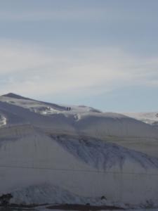
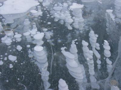
15 November, 2003Rock and Roll! Temperature: 16*F Location: Canada Glacier / Lake Hoare, Dry Valleys We are trying to wrap up all our business here so we can move to Lake Fryxell on Monday. If all goes well, we may even have a few minutes to sneak a hike up behind the mountain in search of the "Rock Garden." This is an area where the winds have sculpted remarkable shapes into the rocks. Roman and I started the day by doing a "food pull." Our team will be out in the field for at least another seven days; we obviously need to have food. Roman and I planned the next several meals and then gathered the items needed to make those meals from the supplies here at camp. The Lake Hoare camp has several "buildings" to go along with the camping sites. There is one main building which serves as the galley, "lounge" area, computer center, and general common area. There are a few other buildings here also; there is an instrument lab, a chemistry lab, a tool shed, and a "shower" room; we're actually allowed one shower a week here! In these buildings are several storage areas where food is stored. The camp manager, Rae, and her assistant, Nevada, helped us "pull" all the food needed for the next several days. Next, Roman went to help Phil break down and put away the generator which had provided the power to successfully melt cables which had been frozen into the ice. I joined up with a man named Bjorn, from Colorado. The LTER group has brought Bjorn in to run precision GPS instruments to assist in monitoring the movement of boulders on the lake ice. Yes, the boulders are moving. Remember the surface ice is melting at different rates depending on what type of material (sand, rock, snow, etc.) is covering the ice in each spot. This difference in melting rates causes a VERY uneven surface to form. The large boulders don't melt the ice as fast as the smaller ones, so often the large boulders will end up elevated on "pedestals" of ice, while the surface ice around them gets eroded away. Eventually these boulders will tumble off their higher ground and shift to a new location. The scientists are using the shifting rates to help them determine the ablation rates at that part of the lake. The researchers can also use the GPS readings from previous years to determine the distance and direction of movement across the lake. Bjorn and I went on a boulder hunt. The boulders in question have been tagged and plotted into the GPS system. All we had to do was follow the GPS signal from one boulder to another. This sounds like an easy task, and on flat ground it would be; but everything is harder in Antarctica! Traversing back and forth across Lake Hoare is no easy task! The surface of the lake is like a maze with pyramid shaped ice mounds blocking the way through. Walking across this lake consists of hoping from one "crest" of ice to another and scampering up and down ice pyramids! Once we found the tagged boulder, Bjorn placed a satellite antennae either directly on the rock or on a pole above the rock. Where the antennae was placed depended on the ability of the antennae to receive a signal from the satellites. We successfully plotted the new locations of these rocks using a GPS system that is accurate to within one centimeter! Now this years data can be entered into the existing data pool and the scientists can start looking for trends. Antarctica gives "bouldering" a whole new meaning! Still having the time of my life!
Contact the TEA in the field at . If you cannot connect through your browser, copy the TEA's e-mail address in the "To:" line of your favorite e-mail package. |