|
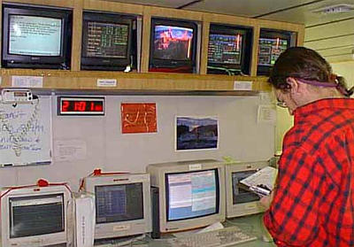
14 February, 1999February 14, 1999 -- Happy Valentine’s Day from the Nathaniel B. Palmer! We sure had a nice surprise for Valentine’s Day today -- heart shaped cookies and a heart shaped cake! By the time dinner was over, they were pretty much demolished . . . but they sure tasted great! Today we spent a lot of time working on our multibeam survey in the Ross Sea. We also took one core of mud from the ocean bottom. Throughout our 12 hour shift, in addition to doing things like coring, we also have other responsibilities. For starters, we keep a log book of all the important data (latitude, longitude, direction we are traveling, speed of the ship, depth of the water, and specific instrument readings) every 15 minutes. While we are writing down all of this information, we are also checking to make sure that all of the instruments and computers are working properly. Yesterday we had some computer problems that needed major fixing, but today things went fairly well. We didn’t see the ice shelf today, but I want to follow up on our question “What is an ice shelf?”. Well, an ice shelf is a large, floating area of ice that is connected to the land. It is formed from the ice sheet that covers most of Antarctica. As this ice sheet approaches the sea, it sometimes extends from the land into the water. Because it is floating and not touching the seafloor, it is called an ice shelf. There are no major ice shelves in the Arctic, but in Antarctica they are huge. The largest are in the Ross and Weddell seas. The Ross Ice Shelf, which we observed yesterday, covers an area larger than the state of Texas! It's average thickness is 335 to 700 meters, but where the front end faces the Ross Sea it is closer to 100 meters thick (part of that is below the water level). As the continental ice sheet moves from the center of Antarctica towards the sea, icebergs calve off the front of the ice shelf to allow for the new ice near the shore. This process does not keep the ice shelf at an exact size, however. According to our observations yesterday, the Ross Ice Shelf seems to be advancing towards the sea. We were able to personally verify this when we tried to multibeam a parcticular area on the map. We plotted the way point (destination) on the map, and gave the latitude and longitude coordinates to the Mate on the Bridge. As it turns out, the point we gave him was actually inside the ice shelf! There was no way we could go to that exact location . . . even though it was open water when the map was originally made! Not all ice shelves seem to be advancing, however. In fact, most ice shelves in the Antarctic Peninsula seem to be shrinking. One possible theory is that this is due to global warming. The Antarctic Peninsula is the northernmost part of the continent, and therefore it is the warmest. Since the 1940s, the average temperature in the Antarctic Peninsula has increased by 2.5 degrees C. This has weakened the ice shelves in that area. In addition, warmer sea water may be causing the ice shelves to melt from underneath. As a result, more than 3000 square miles of ice shelves in the Antarctic Peninsula area have disappeared in the last 50 years. It is important to understand that the gradual breakdown of the ice shelves in the Antarctic Peninsula won't necessarily raise sea levels. If you put an ice cube in a glass of water, the water level goes up as soon as the ice is added. As that ice cube melts, the water level changes very little. Since the ice shelves are already floating, sea level will not change if they melt. The only way sea level would rise due to the gradual disintegration of the Antarctic Peninsula ice shelves would be if their crumbling caused the ice sheet on top of the land to discharge more ice. Even in that situation, however, the rest of the world would feel very little effect. The extra discharge would have to occur from many parts of the Antarctic Ice Sheet, not just near the Peninsula, for large changes in sea level to happen. Before I close for the day, I want to give you something to think about for tomorrow. Several people have written and asked questions about the ship that we are on. If you were going to build a ship, what types of things would you need to think about and include in order for it to be able to conduct scientific research in Antarctica? If you have any questions that you would like to ask (or any suggestions for journal entries or pictures), don’t hesitate to write. We usually receive email 3 to 4 times a day, although sometimes we don’t receive it at all. Due to the fact that we are located in a remote location (and sometimes email gets “lost” in cyberspace), if you send a question and don’t hear an answer within 24 hours or so, please send the question again. Tune in tomorrow! Kim Giesting Latitude: 75 degrees 11 minutes South Longitude: 175 degrees 54 minutes West Temperature: -3 degrees C It may seem like we aren’t moving very much if you are following our longitude and latitude. Remember that we are going back and forth over certain areas of the Ross Sea to make maps and take cores. Sometimes we may spend up to a week in one certain area.
Contact the TEA in the field at . If you cannot connect through your browser, copy the TEA's e-mail address in the "To:" line of your favorite e-mail package. |