|
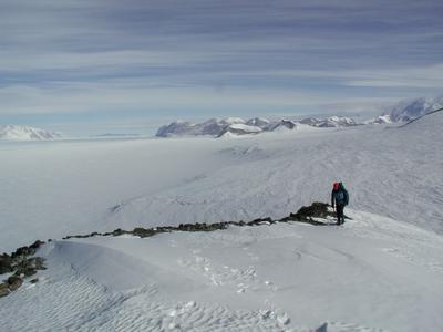
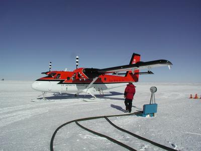
12 December, 2001Today provided me with the most interesting airplane ride I have ever experienced. The collection of today's geologic samples required us to fly up one of the tributaries of the glacier and land as close as possible to our intended location. However, our planned landing site had many obstacles. As we flew into the glacial valley, large debris fields littered the frozen surface. Since landing into massive boulders is not a good practice for pilots, we scouted the area for a long time trying to find a suitable landing site. The sites that appeared clean of any boulders were instead covered by irregular terrain. Plus, as the plane drew near to the steep mountains, downdrafts caused the plane to loss altitude quickly. Out first attempt at landing was quickly aborted when a series of warning alarms rang in the cockpit. The pilot instinctively increased the throttle allowing us to take to the air again. However, the granite face of the mountain was looming before us, which required a very steep turn from the plane. More than one of us were eyeing the motion sickness bags during this evasive action. We eventually landed, but only after the plane was jostled about by unseen irregularities in the ice. As we unloaded our gear, the pilot walked about the glacier looking for a more suitable spot to take off from. Our goal today was to conduct a vertical profile. This involved climbing a very steep glacier covered mountain face. We put on our ice climbing gear and began approaching the mountain. There were quite a few crevices present, which were initially discovered only after our feet broke through the snow covering one. Crevices are dangerous because they are often hidden by overlying snow. The snow acts like a bridge, hiding the danger. Usually, the weight of one person is not enough to break through the snow bridge, but today that was not the case. Although crevices are dangerous, the are beautiful to gaze down. Due to the depth of the crack, the ice looks very blue, like a tropical sea. The ice that we had to climb today was very steep and required a lot of concentration. Using our crampons and ice axes, we clambered upward until reaching the top. The view was amazing, but short lived. The wind was picking up, jeopardizing our ability to fly out of the area, so we hastily began gathering our samples. We stopped every 100 meters during our decent to gather rock samples from the exposed parts of the mountain. Upon reaching bottom, we quickly boarded the plane. The pilot gunned the throttle to break the plane from the grip of the ice. After a bumpy ride, we were again in the air on our way back to camp. The weather continued to worsen, so the pilots and I quickly broke camp and said our goodbyes to the party that would remain in the remote field camp for another three weeks. As the plane flew over them, the pilot rocked the plane back and forth to indicate a wave goodbye. During the two hours it took us to fly back to the South Pole, the weather got worse. Visibility was reduced so much that nothing could be seen. We would be landing in a white out. As the plane decended, every direction looked white...including down. The skill of the Canadian pilots revealed itself again when we safely touched down.
Contact the TEA in the field at . If you cannot connect through your browser, copy the TEA's e-mail address in the "To:" line of your favorite e-mail package. |