|
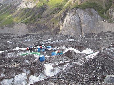
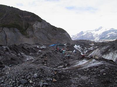
2 July, 2000July 2, 2000 We are in the field, at our respective study sites, and working. The most important thing on everyone's mind was the status of the lake surface elevation. PI Joe Walder (U.S. Geological Survey scientist from the Cascade Volcano Observatory in Vancouver, Washington) radioed the rest of us with some lake level information. Yesterday he let us know that the lake was 10 feet below the high water mark of last year. Last year the lake was filling at about 2 feet per day, so at that pace the surface of the lake should be at last year's maximum elevation in 5 days. This means that the filling of the lake is about a week ahead of last year. But this was yesterday's information………….. This morning, PSU grad student (and lake team member) Michelle Cunico radioed us and told us that the lake had risen 7 inches in 4 hours. This means that the lake is rising at a rate of nearly 4 feet per day. At this rate the high water mark that was measured from last year will be reached in 2 days. Unfortunately this information tells us little about when the lake will drain this year. Kennicott outburst flood dates can vary widely from year to year. It is still not known what triggers the flood. Yet, we all can't help but to compare to last year's conditions as a way to anticipate the timing of this year's flood. We, the drilling team, were placed much closer to the lake on the ice dam than last year. We were expecting to drill here for about 8 days, and then get lifted to a new location further back on the glacier. We were not expecting to be drilling this close to the lake when the drain began. As the lake fills with water, it "floats" the adjacent glacier margin. This glacier margin is the ice dam. We are in an area that appears to have floated and subsequently collapsed last year. Hopefully the lake will not drain under the same lake level conditions as last year. Getting out of this location could be dicey with the number of crevasses that will likely start opening here when the flood starts. Drilling began today. St. Olaf undergraduate student Andrew Malm worked his magic with the ice radar, and let us know straight away that the depth to the bottom of the glacier was about 200 meters. An approximate 60-meter deep hole has been made in about 3 hours. The drilling is accomplished by extruding hot water from the end of a narrow, metal tube that melts a borehole in the glacier. If you want to read more about how glacier drilling works, then see my journal entry from June 27. The first hole will likely be completed by tomorrow. Then it will be time to employ the borehole video camera to look at borehole conditions..

Contact the TEA in the field at . If you cannot connect through your browser, copy the TEA's e-mail address in the "To:" line of your favorite e-mail package. |