|
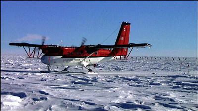
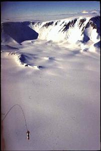
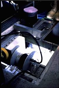
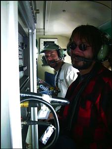
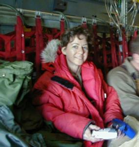
11 November, 1999Meeting the scientists while waiting for the plane south. While waiting for our departure from Christchurch, New Zealand I met Laura Connor and spend some time talking with her about her work in Antarctica. Laura is a Mom with three kids and a husband at home. Once her kids were old enough (now in high school) she went back to school. She is also a "computer scientist" who just finished her Masters degree with a thesis project that deals with the SOAR project. I will explain the SOAR project first and then tell you about Laura Connor's work. SOAR stands for Support Office for Aerogeophysical Research. The team uses a Twin Otter aircraft fitted with data collection devices and collects real time data during flights over specified areas. The goal of SOAR is to provide scientists with high quality aerogerphysical observations of the Antarctic ice sheet. Prior to the SOAR program, data collection was done with hand held devices that required people to be in the field collecting data, limited the amount of data that was collected and produced data with much more error. As the SOAR program developed, instruments for data collection were mounted on the Twin Otter, collected much more data and required a team of scientists to fly with the plane to collect the data than was possible previously. The data was then given to another team who would correct it for instrumentation error and pass the data along to the research team for analysis. Laura worked on writing a computer program that uses real time applications to analyze and characterize the real time systems to make sure the data that is being collected is valid. Her program also bundles and packages the data so that it can be analyzed more quickly. The many instruments collect data every 3 seconds as the plane flies. Altitude, plane speed, changes in tilt all influence the data. If each of the many instruments collect data independently for 3-hour flights, it takes a very long time to figure out what the data means. Laura has written a computer program that monitors the data to make sure the instruments are working correctly, then packages the data in real time so that it is ready to be used. Her system also will detect if an instrument shuts down or stops collecting data for some reason, even for a few minutes. She is then able to see immediately what happens and correct the problem. Prior to her work, whole data sets could be ruined because no one was there to catch instrument failure during the flights. She flies with the team for 3 hours daily and keeps all of the data coming in accurately and in real time as the plane flies. Nine data collecting instruments and six computers are installed on board the plane. When the Twin Otter flies over the Antarctic ice sheet for a specific area being surveyed, data is collected in real time. It is then used by geologists to look at movement of ice sheets and make predictions about the dynamic behavior of the ice sheet. Instrumentation on the plane monitored by real time visualization include the following: 1.A laser altimeter for gauging the plane height above the ice; 2.An ice-penetrating radar system for determining the surface depth as well as layering of the ice; 3.A cesium vapor/sensor magnetometer, towed beneath the plane, for measuring the earth's magnetic field; 4.A specially modified aerogravity system for measuring vertical accelerations of the airplane that provides information about densities and distributions of rock buried beneath the ice sheet; 5. A high -pressure sensor that monitors barometric pressure outside the plane and that is used to calculate vertical displacement of the airplane; 6. A Global Positioning System time code generator giving accurate time; 7. Two GPS navigation systems that indicate position 8. A computer-controlled inertial navigation system to monitor altitude; 9. A ten microsecond counter-timer for sequencing data packets. The ice penetrating radar system measures thickness of the ice and conditions at the ice-to-bedrock interface. This instrument can measure up to 3500 meters with an error of only 10 meters. The airborne gravity system measures variations as small as 1 part in 10 million of the earth's gravity field. The gravity data provides information about rock densities and is useful in locating volcanic remains under the ice and give locations and distributions for the area being surveyed. The magnetometer measures anomalies in the earth's field caused by variations in rocks. This data is used to measure depth and structure of bedrock beneath the ice. This is most useful in the Trans-Antarctic Mountains where buried volcanoes can be found under the ice. The magnetometer is a cesium-vapor instrument that can measure 1part per million in intensity of the earth's magnetic field and must be held in an aerodynamic tube about 100 feet out from the plane (let out by a winch once the plane is airborne). Figures 1 and 2 are compliments of Laura Connor from Austin, Texas. I plan to visit Laura once she gets her instruments installed and operational on the Twin Otter. Students - think about how your physics is applied in SOAR work. How many different pieces of information must be correlated to a specific place and time and altitude and plane speed? What kind of mathematics is most useful when packaging so much information every three seconds? If you were a research geologist, glaciologist, palentologist, or climatologist, how would you approach making meaning from the data? For the computer wizards, what kind of challenges did Laura Connor have to deal with when writing her program? What other uses might be made of such instrumentation? What changes might be made in the future as technology improves?
Contact the TEA in the field at . If you cannot connect through your browser, copy the TEA's e-mail address in the "To:" line of your favorite e-mail package. |