5 December, 2002
Collecting the first set of samples from the first Transect
We are now ready to start collecting our samples from the first transect.
Scott is using the GPS system to locate precisely where we are taking the
samples. The transect will go across the valley and up to above the 300
meter mark on both sides of the valley. Since we are now in an area that at
one time was one large lake called Lake Washburn, we want our sampling to go
above the former shoreline of the ancient lake. Once the location is set, we
will collect 8 samples in each of 6 different quadrangles across our
sampling line. The following is a set of photos showing how we actually
worked in the valley

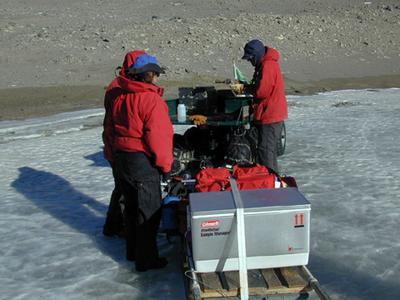
<> Hooking up the ATV to the sled Using the ATV makes our job of collecting easier. Now we will not have to carry the 200 pounds of soil back on our backs!
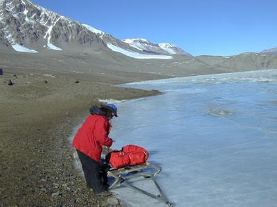
<> Preparing the sled to carry sampling equipment to the end of the lake. We then will carry the equipment another mile to the sampling site.
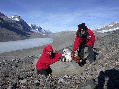
<> Our three mascots come along to all of our sampling sites.
<> Random sampling technique We have now flagged our grid. Imagine the grid divided into 4 equal squares. We will collect 2 random samples in each smaller square. To do this we use an Aerobee. Why does this make a good scientific tool? What problems might we have with this tool? Is there a better or easier way to find a consistent area in a random way within our small square? Do you think the size inside the circle is the right size? What might make a difference in how much soil we collect at each spot? What other equipment do we have to use in collecting the soil sample?
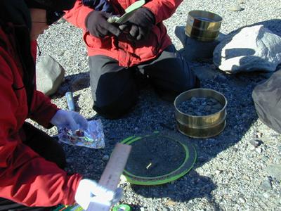
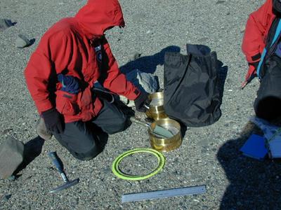
<> Once the Aerobee lands, we begin to collect the soil. Using a clean hand tool, we scoop the soil up and put it into a sieve to strain out the big pieces of rock. The soil sample falls into the second sieve. We then scoop 2 kilograms of soil into a plastic baggie. We use a whorl Pac baggie. Each sample is labeled and dated. How should we label the sample? What kind of information will we need. In one transect, remember, there will be 6 grids and 8 samples taken in each grid.
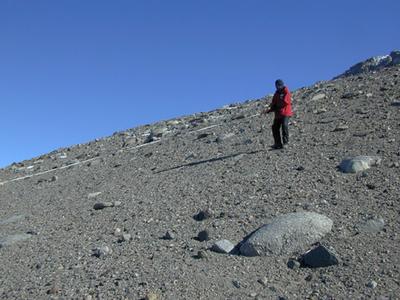
<> Measuring the transect Measuring the first grid in the transect. The first thing we do at the site is to measure out a 20 meter square by using a tape measure and Scott helps orient the square directly North/South for one line and East? West for the second line intersecting at the 10 meter mark. We then put in marker flags. How many flags do you think we will need? Where will we place them to make the most efficient use of time and technique? You might try drawing what you think and compare you're idea with others. Ask me if you have any questions.
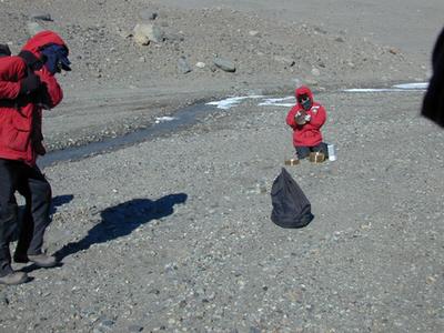
<> Do you remember why we are collecting soil samples? You are correct if you said that we are looking for indigenous yeast populations. In order to be sure that the samples we are collecting are not contaminated, we sterilize all of the equipment between each sampling. How can we do this when we are in the field? We have two sets of equipment so one set is being sanitized while the other set is being used. This makes for efficient use of time.
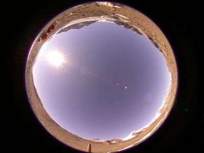
<<1st transect hemi.jpg>> This is a hemispheric photo showing the team ( those tiny red spots) in the first grid of the first transect. True north is shown by the pencil tip near the bottom of the photo. You can see the land all around the edge of the photo. You can also go back to the Island Wood photo with the sun path from the Taylor valley imposed and the photo of the actual sun path for the Seattle area and compare them.
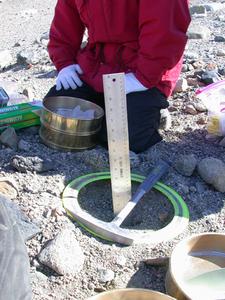
<> After taking each sample we measure the depth of where we dug the soil. The ruler is pushed into the soil until it reaches the permafrost. If you are doing the sampling where you live, how would you measure the depth? Why you think I took this picture? Why is the ice ax in the photo?
<> We completed the whole first transect by 6:30 p.m., then hiked the 1.5 miles back to the sled and ATV with 2 kg of soil per bag, 2 bags per square, 4 squares per grid, and 6 grids per transect. How much soil were we carrying? This field science is both really fun and hard work. You can do a similar grid in your school yard and look for the organisms living in the grid. Then make a list of how many different kinds of living things you find and how many of each are there at the time you sample. What will you find that we will not find? Why? what is different about where you did your sampling?
Contact the TEA in the field at
.
If you cannot connect through your browser, copy the
TEA's e-mail address in the "To:" line of
your favorite e-mail package.
|


