|
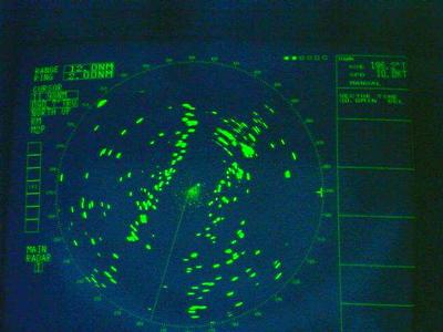
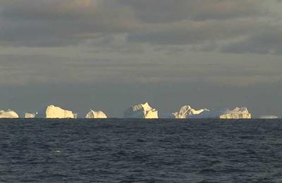
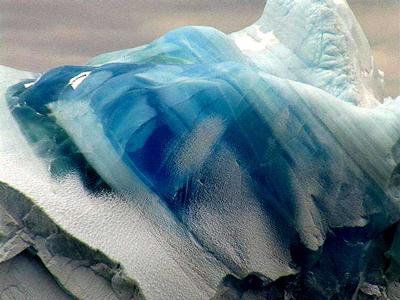
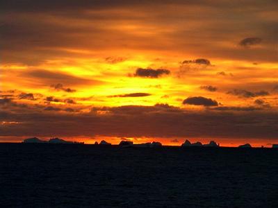
17 March, 2001Iceberg Alley March 17 2001 -067 35 Lat / 062 51 Long We had just finished our shift and were catching lunch in the galley. Amy, our chief scientist, came over to where we were sitting. "Hey guys," she said, "you might not want to go to sleep just yet, we're entering Iceberg Alley and it's a sight you don't want to miss." Tired though we were, we headed up the five flights of stairs to the bridge. Several of the day shift people were already making the most of the view before them. The counter top next to the window was strewn with camera bags and used film, evidence of the attempt to share these memories back home. On the radar screen you could see the Alley, large green dots indicated the presence of icebergs neatly arranged in two rows. We were entering a narrow channel, carved out thousands's of years before by a glacier. The shallow areas on either side of the basin were great for grounding icebergs as they drifted along in the East Wind Drift. * Many of the icebergs were tabular in form (square-topped), meaning they had calved off in the recent past, most likely from nearby glaciers. The channel averaged about 5 miles at the beginning and widened up to around ten miles across nearer the shore. Inside the corridor the seas were calm, a pleasant change from the last two days of rolling waves. I felt like I did when I was in the Grand Canyon, dwarfed by the presence of nature's finest grandeur rising up around me. The only difference was that walls of sheer ice replaced the golden tones of sandstone of the Canyon. We traveled the rest of the day and into the night mapping the sea floor as we went. If all goes well we will be at the Australian base at Mawson tomorrow. * East Wind Drift is a coastal current.
Contact the TEA in the field at . If you cannot connect through your browser, copy the TEA's e-mail address in the "To:" line of your favorite e-mail package. |