27 November, 2000
What is Siple Dome?
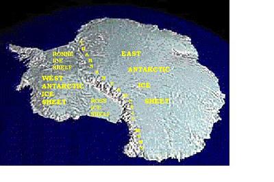
The Transantarctic Mountain Range divides the continent into East and West Antarctica. East Antarctica is capped by an ice sheet up to three miles thick. The ice rests upon land that is above sea level. The smaller West Antarctic Ice Sheet (WAIS) is marine-based, resting mainly on bedrock that is below sea level. Ice streams, moving several meters a day, carry ice down to the vast Ross and Ronne Ice Shelves. These floating expanses of ice are hundreds of meters thick but still attached to the continent. (Image credit: USGS)
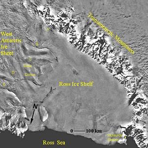
Siple Dome is located on the edge of the WAIS about 600 miles across the Ross Ice Shelf from McMurdo Station. It is a stable piece of the ice sheet. At about 100 miles by 200 miles it’s about the size of New Hampshire. Siple Dome is bounded on the north by ice stream D and on the south by ice stream C (which is currently stagnant).
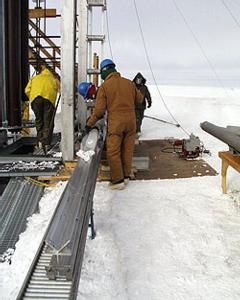
Because of its long-term stability, Siple Dome was chosen as the site for an ice core to be recovered as part of the WAISCORES project. The core, which extended 1000 meters down to bedrock, was removed by a drilling operation during the 1997/1998 and 1998/1999 field seasons. It is providing information about past climates dating back as far as 100,000 years. (Image credit: Jack Williams/USAToday)
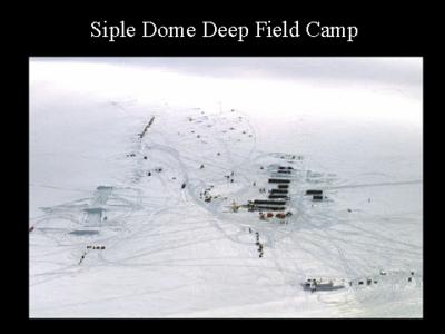
The field camp at Siple Dome housed about 60 people during the drilling project from 1997 to 1999. During the current season there are only about ten of us at the camp. (Image credit: NSF)
Contact the TEA in the field at
.
If you cannot connect through your browser, copy the
TEA's e-mail address in the "To:" line of
your favorite e-mail package.
|


