|
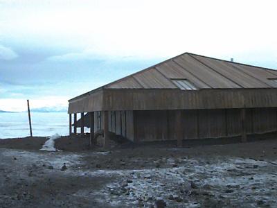
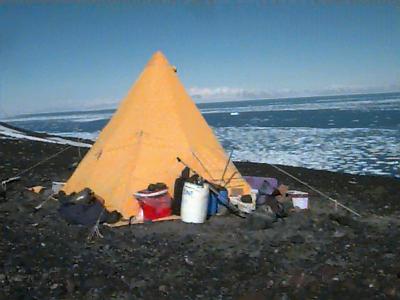
7 January, 2000Today David and I flew in to our field camp on Inclusion Hill with the Coast guard helo. The flight was clear and beautiful. We flew directly over the Erebus Glacier ice tongue. This is a very interesting feature. The ice of the glacier moves down the mountain until it reaches the sea, but the sea is frozen over, so the glacier continues out on the surface of the ice shelf. This creates a long thin mound of crevassed ice and debris from high on Mt. Erebus. The ice tongue extends several miles across the sea ice and is quite dramatic from the air. Upon landing, I met Greg and Denise, who have been doing telemetry from Inclusion hill for nearly 3 weeks. Our camp consisted of one Scott tent and two smaller mountain tents. The Scott tent was used for the kitchen and hanging out, while the mountain tents were used for sleeping. The schedule at Inclusion hill involved three telemetry sessions each day: One at 8 am, 1 pm and 7 pm. Each session involves the tracking of about thirty radio tagged Adelies. Each of these penguins has a tiny transmitter taped to their back. They are tracked from three locations. The person tracking tunes their receiver to the frequency of each individual bird, then uses a directional antennae to locate the direction that the radio signal is coming from. The compass heading is then recorded, and the time noted. At the same time, the people at the other two tracking stations try to get a fix on the bird. With two or even better, three compass bearings on each bird, the position can be determined. This is done by plotting the compass headings from each of the three locations on a map. The three headings should intersect close together. This indicates the location where the bird is. The characteristics of the actual beeping signal tells us if the bird is diving or swimming on the surface or perhaps standing on an ice flow. The signal of a diving bird will disappear for a few minutes then reappear. Swimming birds tend to fade in and out as they porpoise along the surface. A bird that is not going under water at all produces a consistent, clear signal. Radio tracking is a lot of fun when you are able to pick up the signal. Unfortunately, at least half of the birds can’t be found at a given time. They may be too far away, or in a blind spot behind an iceberg or something. Since we are high on a hill top where it is easier to pick up signals, it is very windy at times. Sometimes it is too windy to go out and do the telemetry session as you can’t hang on to the antenna or sometimes even stand up.
Contact the TEA in the field at . If you cannot connect through your browser, copy the TEA's e-mail address in the "To:" line of your favorite e-mail package. |