|
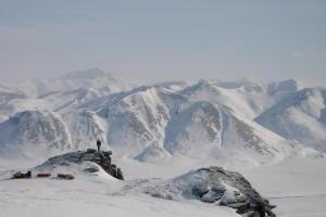
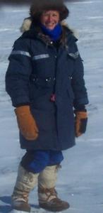
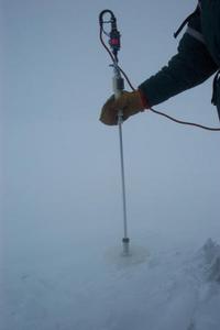
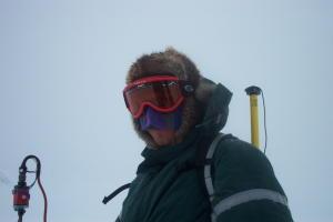
11 April, 2002Let's do some sample GPS/MagnaProbe measurement analysis. If the following depths were recorded on a long walk (these are actual numbers from one of our MagnaProbe lines), how does the terrain appear? Find the average of the following snow depths for each of the terrain/vegetation types. Make a bar graph comparing the snow depths. Question: What relationship do you see between the vegetation type and snow depth? Terrain_Type Depth (centimeters) short shrubs 71.406 short shrubs 37.034 short shrubs 60.334 short shrubs 61.054 short shrubs 69.899 stream channel 57.514 stream channel 65.520 stream channel 93.198 stream channel 95.147 stream channel 75.677 tall shrubs 84.644 tall shrubs 90.221 tall shrubs 99.636 tall shrubs 91.238 tall shrubs 80.984 tundra 16.999 tundra 22.725 tundra 18.978 tundra 17.539 tundra 19.338 trees 111.48 trees 118.22 trees 103.14 trees 115.97 trees 121.34 WHERE IS MRS. CHEUVRONT??? LET'S PLOT!!! LATITUDE: 68.48202 degrees North LONGITUDE: 155.75247 degrees West The temperature has dropped. The mountains have proved that they lie within the Arctic. Morning was cold and brisk. Frost formed on my braids along with my eyelashes. A cold job lay ahead for Glen and I. We would perform a Class 1 Chemical sample in the middle of the Brooks Range Mountains. The remote placement of the sampling site is essential to determine if Arctic haze chemical components are being deposited in the snow. I wore my heaviest parka, my hat, and gave up my warm mittens for two layers of cold latex gloves. The tyvek suit was cumbersome putting on over the layers of clothes. The wind was gracious to us and quieted while we performed the four-hour meticulous job. Our work was finished and it was time to travel out of the Brooks Range. The mountains lead us on a path, a portal out of the mountains. The portal was aligned with steep rocks and sculpted snow. The mountains had granted us a safe journey; they allowed us to bear witness to their beauty. The mountains could be a place of ferocious winds and cold air. We had been blessed with good weather and safe traveling. We traveled out of the mountains and the North slope lay ahead. At the base of the Brooks Range lies a sacred place called the Mesa Site. The Mesa Site sits as a large rock which holds ancient secrets. Archaelogists have found remains from humans dating back to 13,000 years ago. One could imagine a time long ago where humans sat on the rock and looked for mastodons and bisons to be hunted for food. The climate and life was different in the Arctic at that time. Our life on our journey was about to change; Ivotuk would be our safe haven for the evening. Temperature Min -29 degrees Celsius (about -20 degrees F) Temperature max: -19 degrees Celsius Matthew Sturm USA-CRREL-Alaska P.O. Box 35170 Ft. Wainwright, AK 99703 907-353-5183 msturm@crrel.usace.army.mil
Contact the TEA in the field at . If you cannot connect through your browser, copy the TEA's e-mail address in the "To:" line of your favorite e-mail package. |