|
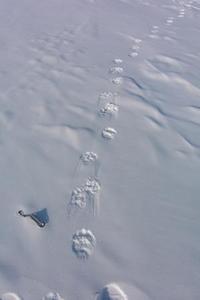
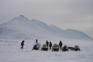
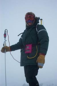
10 April, 2002BEEP, beep, beep. Walk 8 strides. BEEP, beep, beep. Repeat again. Eyes forward, keep walking the straight line. CRASH, Fumble, fall, on your face or back in the deep snow. Snowshoes sticking up in the air, wires and probes lie in a tangled mess. Must get up and keep walking. Push, heave, tug on a tree or a bush, Upright again. Keep walking and beeping until one of the crew retrieves you on a snowmachine. A long, lonely walk in the snow starked Alaska wilderness. Without the beeps, there is nothing but complete, lonesome, silence. This is the scenario that constitutes the GPS/MagnaProbe long walk. The GPS measurements and MagnaProbe gives us the snow depth along a given very-long transect. Our 100-meter line measurements are just a sample of the snow in that given space. The GPS/MagnaProbe measurements give us a more accurate picture of the snow and the terrain surrounding the 100-m sites. A notepad is also carried along to record notes about the terrain along the walk. Notes such as leaving the forest, entering the tundra, crossing an icy pond and crossing a snowmachine track are examples of notes that are recorded. These are all used to paint a picture of the terrain and the snow depth. Each time a 100-meter site is measured, the GPS/MagnaProbe measurements are taken. These measurements allow us to better understand the climate and snow cover North and South of the Brooks Range. WHERE IS MRS. CHEUVRONT??? LET'S PLOT!!! LATITUDE: 68.10908 degrees North LONGITUDE: 156.35880 degrees West The farther we travel into the Brooks Range, the more the Arctic cold greets us. Camp was broken and the day began. A long day of traveling and calculating the route through the mountains was ahead of us. The days of wearing my full Arctic parka had arrived. The sun is still shining but the temperatures have dropped and the wind has arrived. Many abbreviated 100-meter sites were taken along the route. Our route through the mountains seemed as a portal through time. Traveling through valleys, creeks, the mighty Noatak River, and ascending the shoulders of mountain peaks were highlights of our route. Atop a peak, the sun shined, the sky was clear and scattered with diamond dust. Shelter was found behind a small hill and a patch of willows. Camp was set up. Home had been established once again for the evening. The cold had descended; we were deep in the Arctic mountains. Temperature max: -10 degrees Celsius Temperature min: -28 degrees Celsius Matthew Sturm USA-CRREL-Alaska P.O. Box 35170 Ft. Wainwright, AK 99703 907-353-5183 msturm@crrel.usace.army.mil
Contact the TEA in the field at . If you cannot connect through your browser, copy the TEA's e-mail address in the "To:" line of your favorite e-mail package. |