22 June, 2001
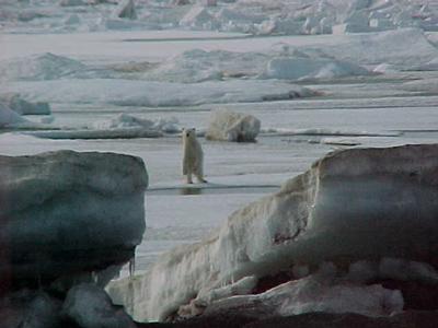
The ultimate arctic experience....a polar bear, at a safe distance of course! This young bear was seen all day Fri. across the beach road from NARL, where all the scientists are staying. This was taken about 7pm.
What an amazing sight! Bottom part of picture you can see the gravel beach so the bear is getting closer.Through out the picture session he was very accommadating, never threatening but with the distance shrinking Dave Ramey (below) steped in.
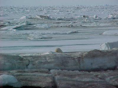
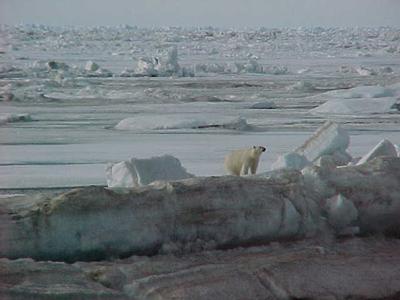
The bear in retreat....with mixed emotions from the audience. Not shown are the 75 plus people with cameras and binos shooting pictures frantically!!
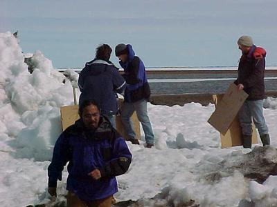
Rommel, Joe, Fred and Stan setting up targets for us to practice our shooting skills. After the bear's appearance we all went out hoan out target skills. The 12 gauge has a kick but with all the clothes we have on no one dislocated their shoulder.! Out of the 7 shooters the happy face on the targets had 3 new parts in their hair!
Ericka, the "tundra terrorist", who would have thought this undergrad from Michigan would have been such a good shot? Is researcher just one of her many lives?
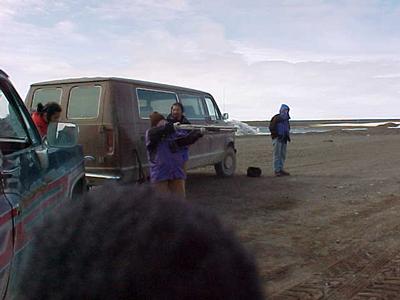
I have my turn. Rommel, Joe and Ats looking on, at a distance.
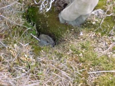
Wildlife on the tundra. We went from the top of the food chain, the bear, to the bottom of the chain in a few hours. A brown lemming checking out its surroundings finds 5 people anoxiously awaiting its appearence! He is dinner for most of the aminals up here, no wonder he's so timid!
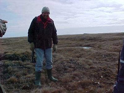
After our safety lesson you see Fred , our designated protector, armed against insurgent lemmings which may rise up at any given time. In reality though, we do go out in the field with a radio and shotgun in the rare event that a bear may happen upon us.
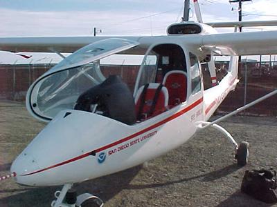
This is the Sky Arrow. SDSU's plane which is lovingly flown (Rommel) and taken care by Rommel and Joe. They arrived yesterday, flew in from Prudhoe Bay. This plane flys a transect (straight line) from Barrow to Atkasook, 50 km. south, as often as possible, all the time collecting flux data over a large area.
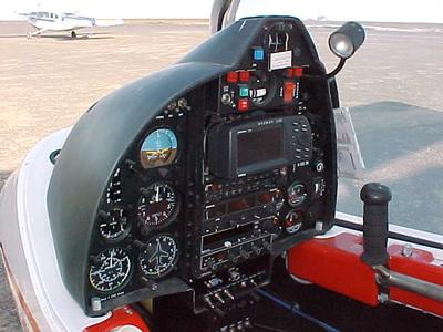
Control panel in the Sky Arrow.
Rommel completing a safty check of the plane before we take off. The Global Change Research Group logo is next to him. Walt Oechel's research group purchased it 2 years ago to extend their research capabilities.
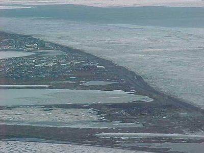
Barrow from the air taken at 10 pm. To the left is the village and on the right is open water. The ice is breaking up but is still present. If you follow the beach road northward (from top to bottom of picture) you will end up at Point Barrow , the farthest northern point in North America.
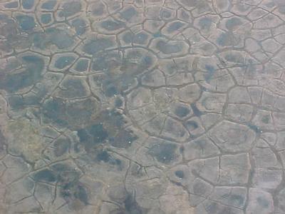
From the air you can see the tundra polygons, a signature land feature on the tundra. These are caused by the freeze -thaw cycle that is constantly happening up here . On the ground you can not see these, that's why it's so helpful to have an ariel view of the areas.
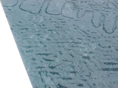
From the air this parcticular ice pattern (top of picture) stood out from all the other pack ice. The explanation is that this pattern develops where thinner ice comes together forming a low pressure ridge then starts melting and drifting apart. The zig zag pattern are the low spots that are melting. (Hey Deb, how close did I come?!)
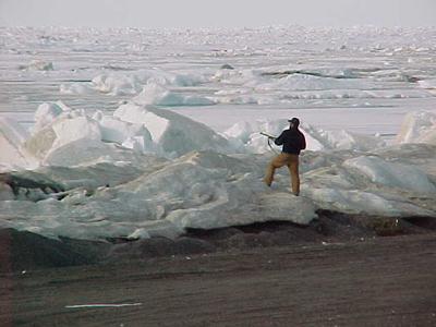
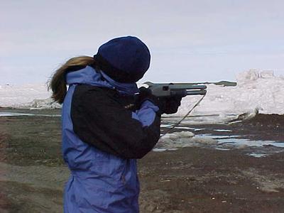
Dave is not shooting at the bear here but over his (?) head to scare it off. He got off 4 rounds of shot, was he successful ? (Look below)
Contact the TEA in the field at
.
If you cannot connect through your browser, copy the
TEA's e-mail address in the "To:" line of
your favorite e-mail package.
|


