|
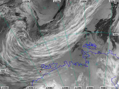
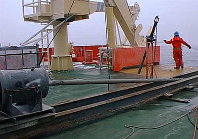
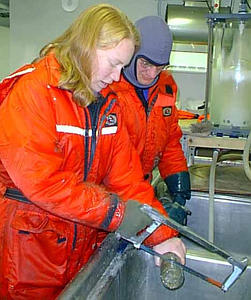
2 March, 1999March 2, 1999 Hello from Antarctica. Today was sure a better day than yesterday! The winds have died down to about 20 knots. As a result, the seas are much calmer, and our scientific data looks much better. During my shift, we took three piston/trigger cores. In addition, we did a nice multibeam survery, and we ran several hours of seismic. It was great! Tonight, the night shift will be finishing the seismic work in this area, which is known as Wrigley Gulf. This parcticular area of water along the Getz Ice Shelf was named after a Chicago manufacturer who helped finance the USAS (United States Antarctic Service) expedition of 1940. Next, we will be moving further east towards Pine Island Bay. Our questions for today were, "How do you suppose that storms in Antarctica are different from those in the United States? How are they similar?" Well, they are the same in that storms are low pressure areas that are spinning. One of the statistics that I list at the bottom of each journal is the barometric pressure in millibars. The lower the barometric pressure, the closer (and the stronger) the storm system. One difference between storms in the Northern and Southern hemispheres is the direction in which they spin. In the Northern Hemisphere, low pressure systems (often referred to as cyclones) spin in a counter-clockwise direction. Thunderstorms, hurricanes, and tornadoes all follow this pattern. In the Southern Hemisphere, low pressure systems spin in the opposite direction -- clockwise! Thunderstorms, hurricanes, and tornadoes in the Southern Hemisphere may look and feel the same to a casual observer, but to someone who looks at those storms from a satellite photo, they can easily see the difference. Another difference between weather in the United States and weather here aboard the Nathaniel B. Palmer is the direction from which it comes. In the United States, most weather patterns are blown across the country from the west towards the east. That's one of the things that meteorologists use to help predict the weather for a certain location. The United States is primarily in an area where the predominant winds come from the west. The continental U.S. is in a wind belt that is called the "Westerlies," which can be found between about 30 and 60 degrees North latitude. There is also a Westerlies wind belt that exists between 30 and 60 degrees South latitude. But I am located at about 74 degrees South latitude. There is a narrow wind belt that exists between the Westerlies and the continent of Antarctica that are known as the Coastal Easterlies. In this area, the predominant wind pattern comes from the east. A similar situation is true in the Northern Hemisphere, where Polar Easterlies can be found between about 60 degrees North latitude and the pole. The land mass of Antarctica, however, keeps the Easterlies in this area much narrower than those in the Northern Hemisphere. The cold, dense air from the ice-covered continent flows down from the middle of the land (which is highest in elevation) towards the coast (which is lower). This is called an inversion wind, and it is driven by gravity. The spinning of the Earth causes these winds to turn slightly towards the west, which helps the Coastal Easterlies to develop (remember, Easterlies come from the east and move towards the west). For the last few days, we have been on the edge of a large low-pressure storm system. As a result, our winds have been fairly high. One way to measure the force of the wind is to use the Beaufort Wind Scale. This scale rates the winds from 0 to 12 -- with 0 being very calm and 12 being exceptionally strong. Here is the Beaufort Wind Scale: 0 Calm <1 miles per hour 1 Light Air 1-3 mph 2 Light Breeze 4-7 mph 3 Gentle Breeze 4-7 mph 4 Moderate Breeze 13-18 mph 5 Fresh Breeze 19-24 mph 6 Strong Breeze 25-31 mph 7 Near Gale 32-38 mph 8 Gale 39-46 mph 9 Strong Gale 47-54 mph 10 Storm 55-63 mph 11 Violent Storm 64-72 mph 12 Hurricane Force 73+ mph So, for the last few days, we've had "strong gale" force winds. How do these winds affect the height of the waves? We'll look at that scale in tomorrow's journal! I hope you're having as great a week as I am! I'm looking forward to hearing questions from you. Kim Giesting Latitude: 74 degrees 03 minutes South Longitude: 129 degrees 28 minutes West Temperature: -4.1 degrees C Barometer: 990.5 mb Wind Speed: 18.6 knots Wind Direction: 72 degrees (from the Northeast) Sunrise: 03:46 Sunset: 19:39
Contact the TEA in the field at . If you cannot connect through your browser, copy the TEA's e-mail address in the "To:" line of your favorite e-mail package. |