
|
|
26 June, 2000
Monday, June 26, 2000
Scraping the Bottom: The Last Dredge
Last Friday evening and into Saturday morning, The USCGC Healy completed
its last science mission of Phase IV, Leg 4. Actually, it was the last
science test for all of the Ice Trials on this, the maiden voyage of the
USCGC Healy. In charge of this last test was Dr. Larry Lawver of the
University of Texas at Austin.
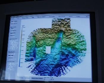
Picture 2 Looking at the Seabeam image in picture 2, the ship made an initial "d-shaped" pattern. The ship traveled from the top of the image to the bottom, then curled around forming the "d". It then crossed at a ninety-degree angle to the line we had sailed "down" earlier, continuing in a line across the image. The ship then looped back down and up the initial line we had traveled. I am not sure how good an image is on the TEA web page, I hope you can see the path we took. Anyway, as we headed back up the way we came, you might be able to see a light blue trough. This is the area we were hoping to find.
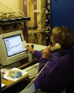
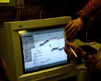
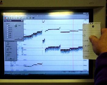
Picture 6 Pictures 4, 5 & 6 It was now time to lower the dredge. Unlike our first dredge earlier in Leg 3, this was going to be a "precision dredge." 250 meters above the dredge bucket; a "pinger" was attached. This pinger helped the scientists figure out where the dredge was in relation to the bottom. In picture 4, you can see a simple scale that was developed, using a piece of paper held up to the screen. Picture 5 clearly shows the Knudsen image displaying two sonar readings; the top one represented the pinger and the other one represented the bottom of the ocean. Using this image, Jim Broda of Woods Hole Oceanographic Institute was able keep track of the positioning of the dredge in relation to the ocean floor and the steep slope. Jim is shown in picture 6. In the aft conning station, all eyes were on the monitor to see how much tension there was on the cable holding the dredge. Normally, at a depth of around 500 meters you would expect the tension measurement to be at 750 pounds, since the wire weighs 1 and a half pounds per meter in water. As the dredge dragged across the bottom the readings varied from 900 to 1200 pounds. As the dredge would bite (snag on a rock or rock formation), the reading would increase quickly to 1,700 pounds. This was still not the bite we were looking for. The largest reading recorded was at 3700 pounds.
Picture 4
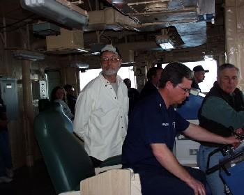
Picture 3 By this time, as seen in picture 3, the aft conning station was beginning to fill with interested onlookers, scientists and Coast Guard personnel. This is where the winch controls are, commanded by MST Glen Hendrickson, and where the ship is also piloted during the dredging. Next-door in the computer / electronics lab the Seabeam and Knudsen sonar images were being monitored.
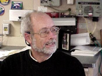
Larry Lawver of U.T. at Austin Picture 1 Larry was looking to test the ships ability to "hold a straight line" during a dredging operation. He was also wanting to "strain the system", by hooking onto a rock structure until it broke off. We were looking to return to an area that looked like it had a significant drop off in depth (similar to a cliff), that we had passed over four days before. The area we were returning to was west of Disko Island, a "flood basalt" formation formed in the early Cenozoic some 62 million years ago. The outer edge of this flow was our target area. Could we find the same spot that had been identified in the evening of Monday the 19th and early morning of the 20th? Yes, in fact we did. We had been told earlier in the day, that we might want to take a nap at some point, because we would not get to the dredge site until very late that evening. It was indeed late when the dredging operation took place. We began the dredging operation around 11 P.M., 23 hundred hours. We began a mapping of the area we had passed over the area four days before. It took about an hour to map out the area we were going to work in.
Picture 5
Contact the TEA in the field at
.
If you cannot connect through your browser, copy the
TEA's e-mail address in the "To:" line of
your favorite e-mail package.
|


