|
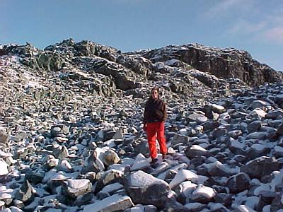
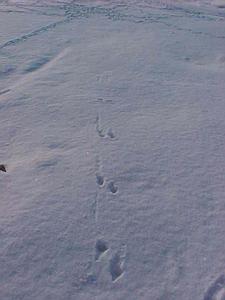
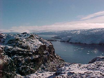
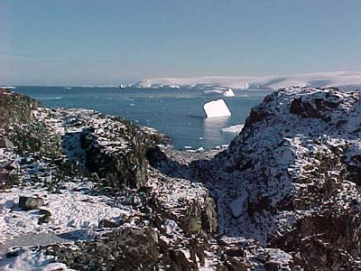
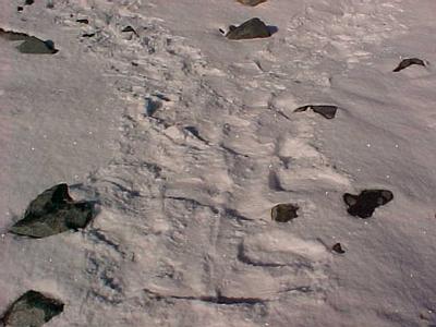
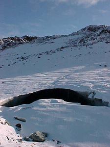
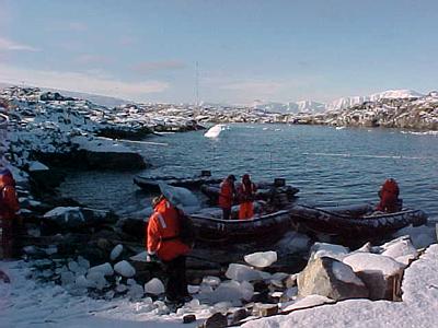
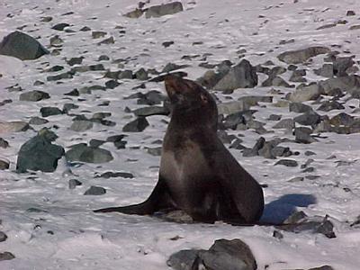
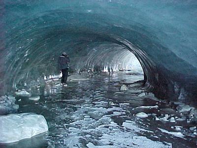
26 March, 2000Ice Cave and Hike to Loudwater Cove; Animal tracks in snow Question 36: Are there any volcanoes in Antarctica? Perfect timing! It is our half day off and there isn't a cloud in the sky. About half the people on the station are taking a boat trip over to Norsel Point to walk through the ice cave and hike. The ice cave is a remnant of the retreating glacial ice that still covers almost all of Anvers Island. It is around 200 meters from the edge of the glacier now and is sheltered from much contact with sun by the tall rock hills next to it. The fresh snow is still clean and white on the ground. It is easy to avoid fur seals today because you can see their tracks before you run into them. I am surprised at how much of the area has already been traversed by seals! Snow was still actively falling last night. They have been very busy going everywhere. There are a few up on rocky hills sunning themselves that are at least 100 meters from the nearest water. Other tracks are visible too. There are little skua footprints running around in delicate line patterns. Some of the tracks tell you what went on. Some are joined by other skuas, some got bombed and harassed from above, several were fighting over food, and at the end of each sequence, a skua took off. The ice cave is in such a cold, dry environment that there is very little melting. Originally it was created by a stream of meltwater coming through the glacier. Now that the glacier isn't connected to it anymore, the walls and floor are smooth and dry. The glacial ice is so dense and clear I can see several feet into the surface. It looks as if it were made out of plastic. There is one icicle forming like a cave feature. Below where the "stalactite" hangs down is the start of a mound of ice, a "stalagmite." I hiked past the ice cave along a valley to one of the largest freshwater lakes in the area. The lake is fed by the glacier which also blocks it from running into the ocean. At the base of the point is the face of the glacier. Rock hills covered with glacial rubble rise in front of it. The tallest are around 110 ft.high. Antarctic and Arctic terns hover overhead and call to each other. After reaching the glacier, I climbed the "peaks" for a good view of Loudwater Cove on the other side of the point. The view was much better than I expected! I could see down the peninsula to the south, the spread of the ice field covering Anvers Island, Palmer Station, and the Joubin Islands 15 miles out toward the open ocean. It is truly a breathtaking place. Our boat had no problems leaving the point, but the other boatload of people was blocked from reaching their Zodiac by a large fur seal that didn't want to give up his place on the rocks. Answer 35: "Spy hopping" is the behavior used by the orca or killer whale to find penguins and seals on ice floes and on the shore. They "stand" vertically near the surface and raise their heads up out of the water to spot their prey. I have also seen Leopard seals do this.

Contact the TEA in the field at . If you cannot connect through your browser, copy the TEA's e-mail address in the "To:" line of your favorite e-mail package. |