|
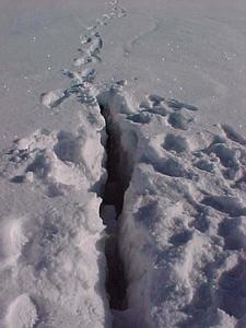
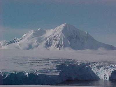
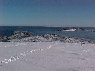
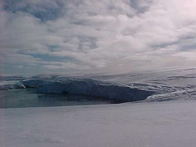
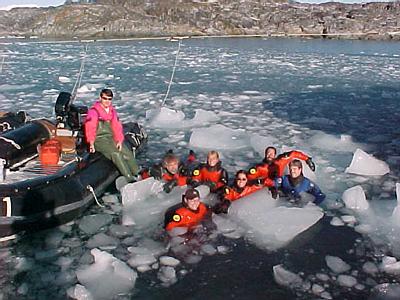
27 March, 2000Marr Glacier; Group Photo Question 37: Where did Mt. Erebus get its name? The last large exodus of summer crew and researchers will happen Tuesday on the R.V.I.B. Nathaniel B. Palmer which arrived today. Everyone here is either busy packing or helping those who are. I am talking to all the departing people about their research and jobs. I will be putting them in future journal entries. Yesterday, after we returned from the ice cave, I had enough spare time to take a hike through Palmer's backyard and up the glacier. The rocky area of Gamage Point between the station and the glacier is referred to as the backyard. It is one of the only places we can go alone and without a radio; we still have to sign out on the board. Especially in the summer, people who are here for lengthy periods of time often set up personal tents in the nooks and crannies between the rocks and sleep away from the station. A shallow lake in the backyard is Palmer's reserve water supply. There is an area of the glacier marked off with flags that is relatively free of cracks and has no crevasses that a person could fall into. The flags keep us away from the edge of the glacier which is actively calving on both sides of the point. We can hike, ski, snowshoe or snowboard anywhere within the flags on our own (radio recommended). I did find one foot-sized crack that was covered up by the new snow. It was surprisingly deep; I went in past my knee! As you climb up the margin of Marr Glacier it starts leveling off. The ice cliffs around the edge of Anvers Island are anywhere from 100 to 200 feet high. The plateau of the ice field where we can walk is around 300 feet above sea level. Elsewhere on the island, the ice/snow field gets as deep as 2000 ft. Walking to the far end of the flagged area over endless, brilliantly sparkling snow, I finally lost sight of the station as it disappeared beyond the curve of the glacier. From the far end of the flagged area you can see all of the islands in the boating area and quite a few of the ones outside the normal boating limits. The large mountains of the southern end of Anvers are clearly visible from base to peak as well. Mt. Moberly is the furthest away and the tallest at 5030 ft. Mt. William is close at 4970 ft. The two are connected by a rocky ridge. The next largest peak, Mt. Hindson, is further south and only 2670 feet tall. These are not the island's tallest mountains. To the northeast on Anvers there is a chain of mountains topped by Mt. Francais, around 9050 or 9250 feet depending on your source, and Mt. Agamemnon, at about 8500 feet. These two peaks are part of the same massif and can be seen over the glacier from the station. Behind and to the south of the Anvers Island mountains, the mountainous coast of Graham Land (the name of this area of the Antarctic Peninsula) is visible. Its peaks are in the 3000-7000 ft range. Before our afternoon dive, everyone in our science group (except Bruce who does not dive) put on their drysuits and hopped into the boat harbor with the brash ice to take a group picture. Jim will be leaving on the R.V.I.B. Palmer so it was our last chance. It was tricky using the chunks of ice to stay in one place without putting so much weight on them that they turned over or scooted away. The harbor is deep; in the picture we are in water many feet over our heads. Answer 36: There are several volcanoes in Antarctica that have been active in recent times. In the South Shetland Islands (off the tip of the Antarctic Peninsula) the volcano on Bridgeman Island was active in 1822 and 1880, and the Deception Island volcano was active most recently between 1967 and 1970. Mount Melbourne is an active volcano on the western edge of the Ross Sea (about 74 degrees S). And probably the best-known Antarctic volcano, Mount Erebus, is over 12,000 feet tall and erupted as recently as 1991. It is located on Ross Island in the Ross Sea.

Contact the TEA in the field at . If you cannot connect through your browser, copy the TEA's e-mail address in the "To:" line of your favorite e-mail package. |