|
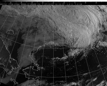
18 July, 2003Friday Check here for daily the mission diary Aerosonde Mission Diary Scroll to the bottom of the page and look for the Mission Diaries section. 7 a.m. Forty degrees F., winds at 22 mph steady and gusting to 32 mph Ceiling approximately 200 feet It sounds wicked out there! The shaking building woke me up at 5:30 a.m. I am not sure about the possibility of the airplanes flying out today. The local NPR station featured the Australian Aerosonde team this morning, but the power went out before I could hear the interview. Apparently the conversation between the tower and the crew yesterday’s landing generated local interest. By all accounts, Dennis and David gave an excellent interview. They even won a York Peppermint Patty as a consolation prize in the trivia contest. The skies are clear all around but we are stuck under a low cloud cover. We have no choice but to wait for this weather system to blow over. Jim will analyze yesterday’s data while we wait. He will also begin constructing a picture mosaic from the images that were collected during yesterday’s flight. There were about 400 images taken; check the pictures at the end of this page to see the ice pack. The images show thin, patchy, flooded ice. This, according to Jim, is a sign of scant polar ice cover for the rest of the summer. Not only is this bad news for polar bears, but for ice-edge animals (seals and walrus) as well. Their habitat could certainly be reduced, yet there is another problem as well. If the summer ice melts away, then there will not be a good base for a build up of mature ice during the fall and winter. Thinner winter ice results in thinner summer ice. Such a cycle could significantly affect the organisms living in polar waters as well as have long-term affects on weather patterns. We may try to fly this afternoon or evening if the weather clears up. With 24-hour sunlight flights are not restricted to “day” or “night”. The Aerosonde team has put in a lot of hours of hard work during prep time. The airplanes are ready to go – now we just have to wait for the weather to cooperate. Since flying was postponed, I went to visit the Heritage Center in Barrow and take a quick tour of the town. Barrow has a population of about 6.000 people, the majority of which are Inupiat. There is also a significant Filipino population. The Heritage Center houses artifacts, personal histories, and information about the Inupiat culture. One can learn about the history of the North Slope cultures (both past and present), paleontology, climate, tundra ecosystems, subsistence living, and native languages. An Elders picnic is planned for this afternoon, and there is a lot of cooking going on in the Traditional Room. Huge slabs of meat are spread out on plastic sheeting and a pot of what looks like fish is simmering outside on the patio. The cooks were concerned about the high winds and whether or not the Elders should be expected to eat outside today. As the Center was closing for lunch, I did not have time to speak with anyone (they were very busy!). Perhaps I will have the opportunity to see them cooking on another day. After leaving the Heritage Center we drove to several spots in Barrow where erosion of the shoreline and bluff area was painfully evident. We stopped to look at the beach at historic Brower’s Café (actually in Browerville), the original site of the Brower family 1880’s whaling station. The beach here was once used for landing airplanes and for baseball games. Now, it is only from 60 to 100 feet wide, and it appears to be eroding further. As we drove along the beach road it was easy to see where sections of bluff and beach had recently collapsed. There were barriers placed along the edges of the road and in the parking lots to mark where the land had crumbled onto the beach. At dinner, one of the cooks asked about my jaunt to Barrow, and I was telling her about the erosion. She said that on the north end, near the point, about a mile of land had been lost since last year. Not much more to do today except wait for the weather to clear. The airplanes are all set for tomorrow.
Contact the TEA in the field at . If you cannot connect through your browser, copy the TEA's e-mail address in the "To:" line of your favorite e-mail package. |