|
|
22 February, 2000
Cathedral of the Bridge
2/22/00
73 08 s
143 37.5 w
East wind 35 km/hr (21 mph), Temp -2.2 C (28 F)
Low overcast
As you have probably noticed, teachers are not always 100%
correct. I told you something wrong in my last journal entry and I want to
correct it. When I was talking about microwave mapping of ice coverage, I
gave the impression that the satellite was actually transmitting
microwaves, which bounced off the ice like radar. This is called active
imaging. The other kind, passive imaging, is in many ways like a normal
snapshot. The satellite "sees" the Earth in the microwave spectrum, using
the microwave energy given off naturally by things on the surface. The 85
GHz images we have on ship come from passive, not active satellites. We all
give off microwaves all the time, but they're very weak. You would never
pop popcorn with the microwaves from an ice floe!
If you've been following the progress of the Nathaniel B. Palmer
on a map, you'll see that we've headed back west and north since yesterday.
What we are trying to do is avoid a large area of heavy pack ice centered
on 74 s 140 w. Between 72 s and 73 s looks relatively clear on satellite
images, so we will try to go east there, then head south at about 130 w.
This should bring us into a large ice-free area centered near 130 w, 74 s.
I hope we can take some cores and do CTDs there, and then sail eastward.
We're out of the worst ice, at least for the time being.
I was on the ship's bridge a little while ago. It is almost dark
for two or three hours at night now. The bridge was dark except for
computer displays, lit dials and indicators, and a red florescent or two.
Using a large green radar display, binoculars, and occasionally, bright
spot lights, the crew picked the clearest path for the ship. Outside the
sea was only half covered with pack ice, mostly big pans of rotten older
ice. A snow petrel circled the ship, and an occasional snowflake shot
through the spotlight beam. When we went through thicker floes, the ship
shuddered. Paul Harvey talked on Armed Forces Network radio, which we
receive by the same satellite that brings you these e-mails, but his volume
was turned down. The atmosphere of the bridge at night is like a cathedral,
and I noticed myself talking quietly.
Even though we haven't taken cores or CTDs lately, we are still
making lots of observations twenty-four hours per day. In addition to the
SeaBeam and geophysical data I told you about earlier, people are
constantly watching and counting seals and other marine mammals.
When I was on the bridge I noticed another log being kept, called the "Ice
Characteristics Log." As part of Dr. Shusun Li's research on snow and ice,
a record is kept of some facts about the ice we see. Observers record time,
date and location. They write down what percent of the sea is ice covered,
estimate the sizes of the ice floes, note if the ice has ridges, and if it
looks like new ice or rotten old ice. Finally, they estimate the thickness
of the ice and the snow on it.
Think of it. If you were on the bridge way above the ice, looking down, how
could you estimate its thickness as it went by? When I found out how it is
done, it answered a question I'd had for a while. I'd wondered about a big
round orange buoy, tied to a rope, hanging over the rail just above the
waterline. What was it doing there? Now I know. As the ship breaks ice,
blocks tend to be stood on edge in the water. As they pass the buoy, an
observer above can use the size of the buoy as a ready reference to
estimate the thickness of snow and ice. The buoy is 40 cm (about 16 inches)
in diameter. As I looked down this evening, the ice and snow together
appeared to be a little more than twice the ball's diameter. Thus I figured
the total thickness was about 1 meter (39.5 inches.)
I've been talking with Dr. Davida Kellogg about diatoms. I found out there
are diatoms in the drinking water at the South Pole station, hundreds of
miles inland, on the Antarctic ice cap. How do you suppose the diatoms
(they were the kind that only live in the ocean) got there? I'll tell you
tomorrow.
Answer to yesterday's question about icebergs: The trails may happen two ways.
First, wind may force pack ice past the bergs, especially if the bergs are
grounded. The pack ice breaks as it goes around the berg, and a trail forms
as if the berg had moved.
Second, The berg may actually have moved (if it isn't a grounded berg).
Icebergs can be affected by deeper water currents which don't act on the
surface ice. Explorer's accounts talk about bergs moving through the pack
ice on windless days. That would be an eerie thing to see!

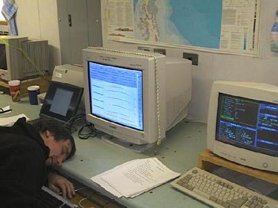
Ping editing is a demanding and exciting part of science! It keeps me on the edge of my chair, or, err... at least on the edge of my desk!
Contact the TEA in the field at
.
If you cannot connect through your browser, copy the
TEA's e-mail address in the "To:" line of
your favorite e-mail package.
|
