|
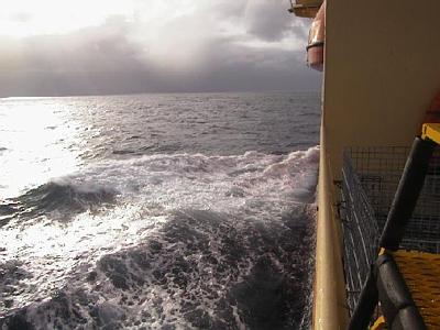
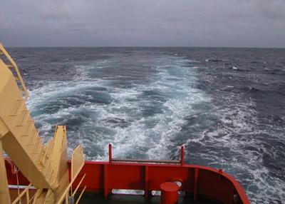
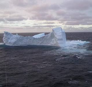
30 March, 2000The Big Thaw 56 34 s, 64 35 w In Drake Passage 299 nautical miles (344 miles) south of Puentas Arenas, Chile Temp +4 C (39 F), winds S @ 12 knots (14 mph), barometer 1000 mb, steady Seas 2-3 m (7-10 ft), depth 3049m (10,001 ft.) Course 354 @12 knots Early this morning we passed the Antarctic Convergence, and as soon as I went out on deck I knew it. There are no signposts marking the line. Before it, we saw waves, sky, birds and open ocean. After it we saw waves, sky, birds and open ocean. But it is a definite boundary. The Antarctic Convergence is a circle surrounding Antarctica, a line where cold, northwest flowing water from the seas surrounding Antarctica sinks. It slides under warmer southeast flowing water from the north. It's not a perfect circle; its latitude varies with longitude and with the seasons, but is usually found between 50 s and 60 s. It cuts down the middle of the Drake Passage. What is it like to cross it? Did I feel a bump, or see a line? No, but all of a sudden, within an hour or so, everything got a lot warmer, the ocean, the air, the ship, and myself. The air had a softer feel to it, and the air temperature rose a few degrees. The water temperature also went up. In the Amundsen Sea it was commonly almost 2 C (28 F.) I just looked at the gauge and it is +3.5 C (38 F) now. The water seems a little grayer and a little bit less blue. Even the clouds seem softer and more diffuse. I've been on boats at the edge of the Gulf Stream, that large river of warm water that flows north along the coast of New England. I noticed the same kind of change entering the Gulf Stream. Antarctica really begins and ends at the convergence. The open ocean which surrounds the poles, and the ring of winds that circle the continent, keep Antarctica in its perpetual deep freeze. Crossing the convergence is like coming out of a walk-in freezer into a summer day. Antarctica wasn't always locked up in a ring of cold. Oxygen isotope records from the bottom of the Pacific Ocean give scientists a history of the size of world ice caps. They show that for a long time, up until about fifteen million years ago, there was no big two-mile thick cake of ice covering Antarctica. There were trees, flowers, streams and land animals (but no people). Then things started getting colder. First, glaciers covered East Antarctica, then about 2-3 million years ago West Antarctica became covered. Since then the ice caps have pulsed, tripling their size and then contracting every 120,000 years or so, but never disappearing completely. During the coldest times, much of the land in the northern hemisphere was ice covered. We passed the warmest part of a cycle about 9000 years ago, and in the long run things should get colder for the next one hundred thousand years. Scientists have a lot of theories as to why these cycles happen, and what effect human activities are having on them. Right now, though, there is no clear understanding and agreement among scientists as to what makes climates change, on a short or long time scale. There are some guesses. Maybe the strength of the sun changes. Maybe the orbital (Milankovitch) cycles of the sun cause the variation. Or it could be periodic rising and subsidence of mountains, or dust or carbon dioxide from volcanoes. Or a combination of these, or something nobody has thought of yet. There is no one clear theory yet. From our present position we have about 30 hours of travel time to Puentas Arenas. We'll pass Cape Horn on our left (port) side, and then enter the Strait of Magellan from the east. Just inside the entrance of the Strait we will pick up a pilot, who will guide us into port. I am going to spend a few days hiking in southern Chile, and then fly through Santiago, Miami, and Boston to my home near Bangor, Maine. Passing the Antarctic Convergence seems to be a good point to end this journal. I have to pack and clean the room where I've lived for the past month and a half. I've got to get pictures and data organized, and help prepare samples for shipping. I also want a chance to say good bye to some of the people who have shared this adventure with me. Oh, and I almost forgot. I've got at least one back journal entry, from earlier this week, to edit and post. I've been putting that off, like back homework, but it's a good one so don't miss it. If you want to contact me, and I hope you will keep doing so, this e-mail address won't work after April 1, and nothing can be forwarded. It would be best to use my home e-mail which is: ler@mint.net I also want to say thank you to all the people, crew and scientists, aboard the Nathaniel B. Palmer, who have put up with all my questions. Of course I'm also grateful to Tom and Davida Kellogg who gave me the chance to get here in the first place. Another thank you goes to the National Science Foundation's Teachers Experiencing Antarctica program, especially to Dr. Stephanie Shipp and Emily Michelle. I don't want to forget Liberty School students, teachers and parents who let me take eight weeks off. And last but not least, thanks to my wife Mary, my daughters Amanda and Emeline, and my mother Mary V. Reynolds, who got through half a Maine winter without my help. Goodbye to all of you, students, teachers, and friends. I'm always glad to answer more questions. Keep looking at maps and dreaming dreams!
Contact the TEA in the field at . If you cannot connect through your browser, copy the TEA's e-mail address in the "To:" line of your favorite e-mail package. |