|
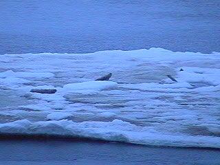
20 July, 2001Dirty Ice? Friday, 20 July 2001 Valkommen! Life on Board Have you ever tried to eat a meal sitting at a table in the back of an old pickup traveling on a dirt road, complete with washboards, potholes, anthills, rocks, and downed trees across the road? If so, you have an idea of how our mealtimes are in the mess hall. It is unfortunate when you are carrying a tray of food back to the table from the food line and the ship suddenly hits a large ice floe on the starboard side. Everyone walks with his or her legs braced far apart in case of this sudden violent lurching. It looks like a John Wayne convention. In another attempt to keep everything where it should be, all of the refrigerators have latches on the outside to keep the food inside. Apparently someone eating a late snack last night neglected to latch one of the refrigerators and EVERYTHING inside ended up on the floor. Quite a mess. Maybe that is why they call it a mess hall. Where Are We Now? It has been a gorgeous sunny afternoon and evening (no sunset!) with a little fog in the air to diffuse the light into a golden haze over the landscape. We had a short 1-hour station this afternoon with a chance for a few groups to go onto the ice and quickly take some measurements. The length of time we spend at any station during this leg of the journey is dependent on the depth of the ocean at that point and how far down the sampling rosette has to go. For example, the last 4-hour station we had was when the ocean depth was 4.5 kilometers and it took the Oceanography Team that long to lower the CTD/rosette and bring it back up. The other groups are happy when we are in deep water because it gives them more time to go onto the ice and collect data, snow, and ice. We are heading for another short station, Station 17, tonight but due to the heavy ice pack, they can't tell us when we will get to where they want to be. I have to process water samples at that station so I may have to get up at some strange hour. Such is life in the ice. Current position is 86o43í North and 53o11í East as we continue north towards the Lomonosov Ridge. By the way, I hope the cruise track image that I sent made it to the Web site. That image was courtesy of Michael Jensen, Cooperative Institute for Research in Environmental Sciences (CIRES), Boulder, Colorado. Scientists at Work For the last few days, I have been noticing that much of the ice in sight appears to be dirty, in layers interspersed with cleaner ice and bands of different colors. We are now far enough north that we are into multiyear ice, or ice that has remained unmelted for 2 summers. I assumed it was an increase in the brown sea algae that is common on the underside of the ice and in layers left over from the years before. At our last station, I was surprised to find large, broken pieces of driftwood, tree trunks almost, on a small, dirty ice floe next to the ship. At this afternoon's meeting of the atmospheric chemistry group, I learned the origin of this unusual sight. There is something called the Arctic Drift that defines a path that ice follows through the Arctic from Siberia across the pole and down through the Greenland Sea between Spitzbergen and Greenland to the Atlantic Ocean where it melts. Rivers flowing out of Siberia carry dirt and other debris, like trees, into the ocean where they get trapped in the ice. The Arctic Drift then carries this ice along across the top of the world and down the other side. If you encounter this Arctic Drift at any point along its path, you may find Siberian artifacts but I don't know how long it takes something to work its way from Siberia to Greenland in the ice. Vi ses! (See you later!) From Deck 4 on the Icebreaker Oden, somewhere north of 86, Dena Rosenberger
Contact the TEA in the field at . If you cannot connect through your browser, copy the TEA's e-mail address in the "To:" line of your favorite e-mail package. |