
|
|


Archive/
I was a member of a research team investigating processes that occur high above the surface of the Earth. Because we can't go there in person, we use radar to collect our information. This is a remote sensing technique. Remote sensing involves collecting
information about a region without actually visiting it. Just like explorers of the deep sea may use a remotely operated vehicle (ROV) to get images of sunken ships, we use instruments that measure electromagnetic radiation to gather information about ou
r atmosphere. The movement of charged parcticles creates electromagnetic waves, and the thermal (heat) vibration of parcticles gives off electromagnetic radiation according on their temperature. Electromagnetic signals generated by parcticles in our atmosphe
re can be detected by radar on Earth.
I assisted in the installation and testing of a radar network in Greenland designed to study dynamics of the atmosphere at a height of 60 to 110 kilometers (37 to 68 miles). The boundary between two layers of our atmosphere (the mesosphere and thermosph
ere) occurs within this height range, and the researchers are parcticularly interested in the processes linking these layers.
Remote sensing techniques are invaluable in studying global-scale processes and taking continuous observations of the behavior of the atmosphere. The goal of the research I was involved with is to understand how the processes by which energy is distribut
ed in the upper middle atmosphere. They are using electromagnetic signals to investigate dynamic features such as tides, gravity waves, and atmospheric photochemistry (chemical reactions that occur due to the sun's energy).
Results from this research will be used to provide direction for future
research, to aid construction of atmospheric models, and to test the
performance of these models.
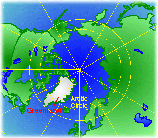
Sondrestrom region of Greenland.
Return to top of page
|
