|
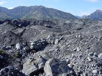
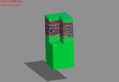
2 August, 2002Another glorious day on the Matanuska........ Today I helped Laura Gilcrist, an REU student from the University at Buffalo (the same university where Dr. Baker works) with her research project. Lauraąs site is located at the northern edge of the glacier at the very margin between glacier and moraine. Her investigation involves attempting to find a correlation between the depth of buried ice, and the presence of vegetation. Plants require a relatively stable medium in which to grow. A simplified version of one of her hypotheses would be: if the ground surface is rapidly changing due to the movement of sediments on the surface as a result of melting ice beneath, vegetation will likely not establish readily. If a correlation between the depth of buried ice and the presence of vegetation on these moraine features can be established, then the presence of vegetation alone could serve as an indication of the depth to buried ice. Approximately a week ago Laura gathered GPR data with Dr. Baker at four different location in her research area in an attempt to determine the depth of buried ice at these sites. One location was a profile line that ran from debris covered ice to an area covered with low growing shrubs. The other three locations were 10m x 10m grids, one completely debris covered, another covered with debris and some vegetation and the third completely covered with vegetation. I have attached an image of some of the processed data from one of the sites. Today, Laura and I collected survey data from the four sites. This data will allow her to construct surface maps of the study areas. The surface maps in conjunction with the GPR data will allow for a clear picture of how the depth to buried ice in these regions relates to surface topography. The sun, the breeze, the mountains, the ice......... Life Is Good, DT
Contact the TEA in the field at . If you cannot connect through your browser, copy the TEA's e-mail address in the "To:" line of your favorite e-mail package. |