|
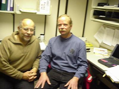
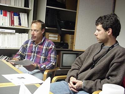
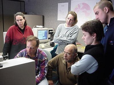
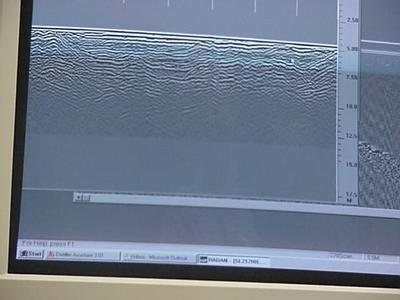
18 November, 1999Thursday November 18, 1999 Got up at 0400 hours wanted to do email early on because Barb and I have a make up class with one of our parcticipants at 0700 hours. I had some great emails from people across the world. As far away as Tasmania. Whoops now that I think of it Tasmania is really quite close. I would guess, and that's all it is, is a guess, about 1000 miles. It is really nice to know your enjoying the journals. I'm a bit of afraid to say this ,but if you'd like to drop me a note way down here at the bottom of the world, I'm not promising, but I will try to respond. Our 0700 student never showed so we worked on tonight's workshop. We are all set. I ordered an overhead and Barb spoke with Steve Arcone so he will still present tonight. I had to run to the photocopier and ran into a man who was looking for me. He looked a little familiar, but I had no clue. He was Gregg Lamorey. He had been at our five-minute presentation last nigh and was extremely interested in our project. Great!! He talked for a few minutes and I invited him to come back to our office and meet Barb. Gregg is a researcher at Siple Dome, a deep-field camp (one which helicopter cannot get to) that is located about 1.5 hours northwest of here by LC-130. I think he said he has spent more time at Siple Dome then any other human. Gregg was loaded with information and willing to share it. He talked about last year's coring operation that brought out a core 1004 meters long. He said that the bottom of the core was from about 100,00 years ago. These cores can come out in lengths of up to 5-meters. This led him into talking about his project this year. When cores are pulled out, depending on the depth (pressure) and temperature, and accumulation rate sometimes they are "brittle". The example he gave was a 1 meter long core of "brittle ice" would be the most one person could carry without it breaking, whereas a non-brittle 5-meter long core, with one person on each end could be carried without it breaking. What they have discovered was that if the cores are left buried in an ice trench they become less brittle with little or no loss of the original physical properties. I am not really sure that they know why. So after pulling the core last year they placed this core, obviously in sections, into an 8-m deep by 200' long trench and this years project was to recover, document and ship these back to McMurdo to the ice core storage facility. Then when the cargo ship arrives to California and finally on to the Ice Core Lab Facility in Colorado. Keep in mind that refrigeration now becomes most critical. They need core tubes full of ice not liquid water. Gregg talked about the ways cores are dated. One way is to look for dust layers. He stated that the more dust in a layer meant that that the layer existed during a colder times. He talked about analyzing the ratio of O18/O16 in the ice. As I understand it, the colder it is the more of the heavy isotopes fall out, so I assume that ratio would get smaller. I'll try to check that out for you. Gregg talked about looking, or better yet, finding organisms because these can be dated with processes based on things like Carbon14 dating. The best find would be volcanic ash, for there have been very few, but specific times when this would appear. (like after a major volcanic eruptions ). See the list below of major volcanic eruptions (those that influenced the entire globe). 1994 Agung 1912 Katamori 1883 Kakatoa 1815 Tamboura 1793 Laki. What all this does is to correlate layers of ash with when they could have occurred. For example, at McMurdo the ash layer for the Tamboura eruption of 1815, an enormous explosion that threw so much ash into the air that 1816 became known as the year without a summer, is at 39.4 meters deep. Thus, anything deeper then that has to be older. One of the objectives is to try and document, by more then one of these means, the age of these different layers in the cores. Another tool used to document the age of a layer is chemical. The concentration of H2O2 hydrogen peroxide) increases in summer months so there are annual peaks and valleys when you measure the concentration in the different layers. Gregg talked about the fact that if the surface layer of snow accumulation is 10 cm in deep cores this might be only a couple of centimeters thick. I thought it was due to the pressure, but he explained that the ice at great depths acts more like an elastic band being stretched to the sides, rather then compressing. Amazing! He described how they dig snow pits at various AWS (automatic weather stations) at Siple Dome. I did a lot of this on the Palmer back in 1992. These are cross sections of snow where they look at the physical properties: temperature, grain size appearance, etc of the snow in order to document the AWS data sets. It sounds like dig and document. Sorry bad pun. Gregg shared with us a most amazing web site www.dri.edu/WRC/waiscores. Check it out, it is awesome and has all levels of interest and abilities addressed in it. He then went on to talk about his outreach program that he works with in Alaska called the Juneau Ice Field Research Program, out of U. of Idaho and it is for high school kids. Kids actually go to the glaciers to do real hands on, dirty, get wet and cold science. Wow! Where were these opportunities when I was a kid? Anyone interested? I'm too old. I was most impressed with Dr. Lamorey: as a scientist, and educator and a person. Plus he is a great guy "to-boot". He actually, if we can get manifested for a flight to Siple Dome, extended us a personal invite. Boy would that be awesome! I spent the rest of the afternoon typing and organizing stuff for our class. Of course the doors to the building were not unlocked and I had to act as a doorman once again. The class went well, but, changes in people's schedules are driving me nuts. Of course most of you realize this is a short drive anyhow. Dr. Steve Arcone came in to explain the ITASE project and talk about some of the science he personally will do. This project is funded for 17 proposals, but only 11 people will be going on the traverse. Each group will be looking at numerous things and getting data sets for other groups. The reason for this is that any grant moneys awarded for research in Antarctica have 80% of the money go to support. Steve said that this was a major project. As an example he said it would take a total of 9 Hercules LC-130 flights just to set up the field camp. There would be two Tuckers pulling very large sledges (20,000 lbs. each) and four snowmobiles. The sledges would carry a laboratory, supplies, tents equipment, and serve as a method for transporting the cores. Each core has to be wrapped in polyethylene sheeting to prevent sublimation. (What is meant by sublimation? Why is it such a possibility in Anarctica?) Whatever is needed from, Tukers to toilet paper, must be brought in and brought out. The bringing out part will be delayed for much of the heavy equipment and many of the structures that are being brought in will be left a Byrd Station Camp for the rest of the project. This project could last from at least four years and possibly longer. It really is a project and a big deal. Steve is a radar expert and he talked about using his radar to see the different layers in the snow, firn and ice. (What is firn?) He explained, and actually showed us some data from his radar scans in the Dry Valleys. It is most interesting to see that different "stuff" leaves different radar signatures (finger prints). Steve's radar provide the ITASE team with three things: correlatation of ice core layers the density shifts at the various phase, or transition layers of the snow, they can give a good indication of where the drillers should drill . You want to drill where the layers are flat so that the deeper you go the father back in time you go and thirdly they can be used to spot crevasses. The why behind such a major project is to monitor the West Antarctic Ice Sheet (WAIS). This sheet of ice actually extends out over the ocean, unlike most of the East Antarctic Ice Sheets an in many areas has as much as 2000m of ice below the water's surface. The significance of this is that if there is global warming, and if it has an effect on Antarctica this would be the area of most concern. Ice sheets that have no watery base move by one ice crystal pushing the next ice crystal ("crystalographic creep") or about 10 meter/year, whereas ice sheets that have a watery base move about 300-400 meters per year . The wetness of the base does not have to be due to floating on a sea or ocean only. There are a couple mechanisms that will give the same effect. With ice over 2,000 meters thick pressure can cause liquefaction (ice will met under enormous pressure). [since pressure is often measured in kg/cm squared, anyone want to try and figure out the pressure under 2000m of ice.] There is also the geothermal heating of the bottom of the glaciers (ice sheets) from the molten core of the earth visa vie volcanic activity. Whatever the mechanism, the concern is that the WAIS might be loosing more snow than gaining and this could be disastrous because this 2000 meters of subsurface ice could "pop up", break off and float north and melt. Global warming has occurred in the past and it could occur in the future. There is documentation that roughly 20,000 years ago the earth's climate changed dramatically and quickly. How about the average temperature increase by 20oF in a period of time as short as 12 years, but no more then 20 years. That is amazing! If the ice here melted the sea levels would rise between 60 and 80 meters. Hope you can swim. We left the conference room at Crary and went to the computer training room at building 155. The group worked well and we finished up around 2230 hours. I went and typed till 1230 hours and then went to midrats. I and one of our project parcticipants shared dinner together. She was saying how this is her first trip to the ice, the work is very hard and long 60 hr/week, but the beauty and aura of the place makes it all worthwhile. I agree. It's 0230 hours and time to go to sleep. Good night, Penguin Peter the Polar Man
Contact the TEA in the field at . If you cannot connect through your browser, copy the TEA's e-mail address in the "To:" line of your favorite e-mail package. |