
|
|
3 July, 2003
Back to Work
Today in Kotzebue
I’m wearing long
johns, boots, long sleeved shirt, fleece jacket, wool socks and boots
and still it is a bit nippy here. That’s what life is like in the
Arctic Circle. One year ago there was a blizzard on this date, so I
guess I should count myself lucky that it is only in the 40’s.
What Science Is Happening?
Picture this: you are using a steering wheel to maneuver your
vehicle between points on the video screen in front of you. You get
the most number of points for aiming exactly in the center of the
street you are on, you use the reverse and throttle to accomplish you
objective.
What are you doing?
A.) Playing Pole
Postion
B.) Playing Street Machines
C.) Playing
Nascar 2003
D.) Making an under water map.
If you said D
you are, of course, correct. We spent 7 hours on a boat with Captain
John Goodwin mapping the near shore Kotzebue area. (For more on Mr.
Goodwin, tribal elder see journal dated April 24th).
Question
1:
Why do you need a map of water?
It is not the water itself that
we are mapping, but the bottom surface. We need to map before we begin
sampling so we can take variables into account. If we find more life
on one area than another then we need to know is this because of the
depth of the water or for some other reason. For example we came a
across a sand bar and several readings were only 2.5 feet deep,
however, not too far from that there is a channel dug into the ocean
floor so barges can bring supplies to Kotzebue and the water is 50 feet
deep.
Question 2: How do you map the bottom of the water?
We use two different instruments: First we use a GPS or Global
Positioning System. This handy piece of equipment is becoming more
popular and widely used. It uses satellites circling the earth to give
you and EXACT reading of where you are with in a few feet. We drive
back and forth making lines over the area we wanted to map.
Every
100 yards or so we stopped and looked at depth finder. This is a radar
device that tells us how deep the water is below us. It sends a signal
down and records the echo as it bounces back from the bottom, just like
a submarine or the echolocation used by dolphins and whales. We then
wove back and forth across our lines, using the GPS to tell us where we
had been before and aiming exactly in the middle to get an even
location between the points.
When we returned, we fed this
information into the computer (mostly my job), tomorrow we will sort it
and the computer will make a 3 dimensional map. When we have that we
can decide the points at which we will take samples.
Classroom Connections:
Things for you to think about (answers tomorrow)
1.) Would you expect different, more or less animals
in the deeper water. Why or why not?
2.) I could not see very far
down in the water, even when we were in 2 feet. Does then mean that
the water is dirty or clean? Is there more likely to be life in murky
green water or clear blue water, why or why not?
3.) Tomorrow is the
4th of July. People here go all out, it is the big summer holiday and
every one parcticipates. I was very surprised to learn then that there
are no fireworks. Why do you think this is? (Hint: They DO have them
on New Years Eve.)
What other things have you heard a GPS being used
for? 4.) Make some guesses at other things a GPS could tell us.
Links
Learn
more about our project here
View curriculum for this project, “Ask a Scientist” and
learn about other Arctic Real Time research at Arctic Alive
City of
Kotzebue Webpage
Listen to the local radio station KOTZ live
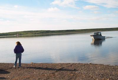
The boat coming to take us out to do mapping.
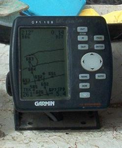
This is the GPS unit we used to make a map. First we made lines parallel to shore and then perpendicular.
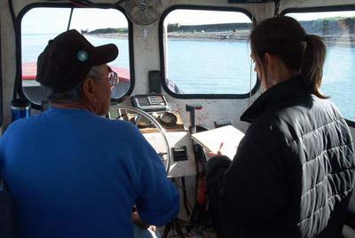
Melinda and John discussing the best way to get a cross section of the area.
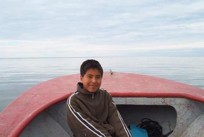
Gerald is our boat captains grandson and our biggest helper.
Contact the TEA in the field at
.
If you cannot connect through your browser, copy the
TEA's e-mail address in the "To:" line of
your favorite e-mail package.
|


