|
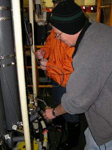
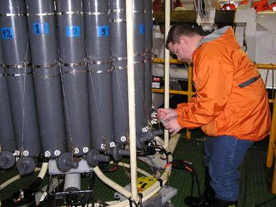
12 July, 2003We're hitting the stations pretty hard now. After a short section in the Bering Sea a couple of days ago, and a few stations along the way, we have begun an intensive program of closely spaced stations beginning at a point a few miles east of Point Barrow, Alaska. From there we head in a northeasterly direction stopping every 3 miles or so to lower the rosette and collect our samples. In practical terms, this means that no sooner have we finished one station, the ship has arrived at the next. I began my watch at noon on station 16, and by midnight, we were doing station 24. A station, by the way, is simply a location where we cast (drop) the rosette. Our current location, for example, is 72 degrees, 5 minutes north latitude and 154 degrees, 1 minute west longitude. A line of stations is called a section. Each section has been planned by Jim Swift, the Chief Scientist, and takes into account the nature of the ocean bottom. Our highest priority work will consist of approximately 4 closely-spaced shelf-basin sections and 3 similarly-spaced sections across the underwater Barrow Canyon. Of course, ice conditions can modify the plan at anytime. After station 26, the ship will take a "break" and come to a halt while we wait for the lab folks to process the samples from the rosette bottles; in other words, we can collect water samples faster than we can measure them. The break should give many of us time to catch up on things like reading, laundry, exercise, and sleeping.
Contact the TEA in the field at . If you cannot connect through your browser, copy the TEA's e-mail address in the "To:" line of your favorite e-mail package. |