|
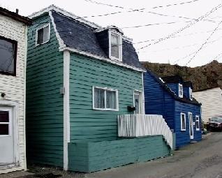
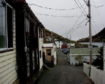
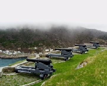
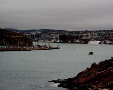
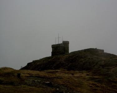
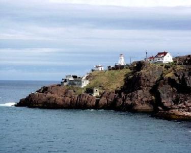
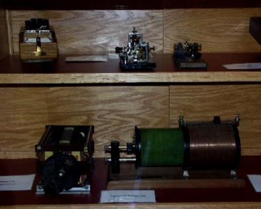
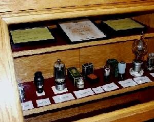
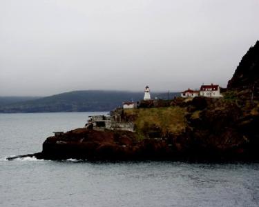
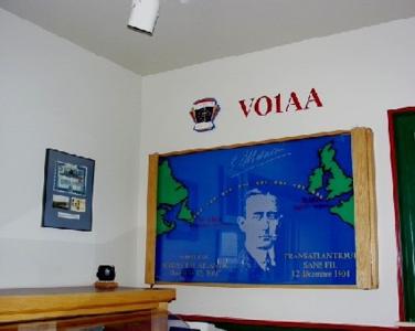
21 May, 2000About St. John's May 21, 2000 Daily Data: Around 11:30 PM the air temperature reading was 34.7 degrees Fahrenheit from the USCGC Healy docked at Pier 17. What is this temperature reading in degrees Celsius? (Refer to my journal entry of May 20, 2000 "Fahrenheit to Celsius.") Facts on St. John's, Newfoundland: Area: 186 sq mi/483 sq km Population: 101,936 (metro area-173,097) Time Zone: Newfoundland, 3.5 hours behind Greenwich Mean Time. Daylight Saving Time is observed April-October Dear Everyone, St. John's is the provincial capital of Newfoundland and Labrador. Although it looks much younger than it is, St. John's is one of the oldest cities in North America. The great fire of 1892 and another fire in 1992 leave few buildings that predate the mid 1800s. St. John's is a working seaport. Legend says that John Cabot first discovered St. John's in 1497 although the exact location of his first landing is open for debate. Over the years, explorers, adventurers, pirates and seafarers have made their way to St. John's attractive naturally sheltered harbor. St. John's is the most easterly port city in North America and was claimed by Sir Humphrey Gilbert for the British Empire in 1583. Although I haven't shopped, there seems to be many art galleries and craft stores. Newfoundland handicrafts such as pottery, jewelry, hand-knit woolens, soapstone carvings, crochet work, hooked mats and rugs and duffel work (heavy wool embroidered in Arctic themes) is popular. It is obvious that dining is an important part of St. John's vibrant nightlife. Seafood, of course, is a specialty. Yes, I tried cod tongues and cheeks and I was not disappointed. A lovely partridgeberry and pear torte with vanilla ice cream and raspberry coulis for dessert one evening completed another local "must-try" of partridgeberries. Signal Hill greeted the Healy as we negotiated into the St. John's Harbor area. The hill has long been used for defense, observation and communication. Signalmen surveyed the ocean for ships headed into St. John' s Harbor many years before the dawn of ship to shore radio. Flags from masts high on the hilltop conveyed information about approaching vessels to St. John's military and merchants. This gave everyone plenty of time to prepare for incoming ships. With its obvious strategic location, the fortification of Signal Hill began during the Napoleonic Wars. It became the site of St. John's military defenses and remnants of the military fortress are still visible today. Cabot Tower was built in 1897 in the honor of Queen Victoria's Diamond Jubilee and the 400th anniversary of John Cabot's "Voyage of Discovery." The tower was used until 1960 and houses exhibits of Marconi's historic wireless reception. Best regards, Sandra Kolb sandrakolb@hotmail.com <../tea_kolbfrontpage.html> <../> <../>
Contact the TEA in the field at . If you cannot connect through your browser, copy the TEA's e-mail address in the "To:" line of your favorite e-mail package. |