|
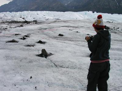
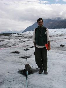
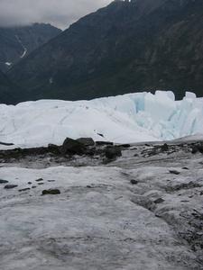
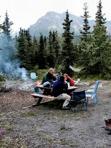
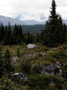
29 July, 2001Looking for tombstones and measuring rocks; Data interpretation-Part 2 6:30 a.m. July 30 Last night, I lent the computer to people who were desperate for e-mail; when we get used to communicating with friends and family via e-mail, six weeks becomes a long time to be cut off. Consequently, I did not start my journal until this morning. So now I write sitting on the deck of the bat cave (computer tent) listening to the rushing of the river and watching the clouds play with the sun over the ridges of the Chugach Mountains. For clarity's sake, from here to the end, I will be referring to July 29 as "today", "this morning", etc. Life on ice ... almost Greg and Kendra left this morning around 9 a.m., as did the guys working for CRREL. (Greg and Kendra are doing a seismic study near Fairbanks. The CRREL guys are going camping in Denali National Park.) With their departures, the atmosphere in the camp changed and shifted to accommodate the hole left in their absence. Shortly after they left, Staci and I went to change water bottles at the ISCO water stations (see Marvin Giesting's journal from last year... He was here changing these bottles all last summer!). The rest of the day was spent helping out REU students in one way or another: Justin is measuring how ice got trapped in the end moraine of the glacier< /i> Several days ago, we took GPR data of the area to find the layers of sediment and use that data to learn something about the history of deposits of sediment. To make this data as accurate as possible, Justin needed to measure the elevation (height) of the hills and dips in the area so Greg can accurately line up the data from below the surface. Justin spent the day yesterday using a surveyor's tool to measure the elevation of hundreds of different points in the area. This morning, Nelson, Jeff and I drove into Palmer to return the rented equipment. Andrea is measuring lichen growth on the glacier to determine the age of the different moraines in the area On the way back, we searched the area for cemeteries. We found one in Palmer, but none in the former mining towns on the road from Palmer to Matanuska. We were looking for a way to find out how fast lichen grows in this area. If we had found a 10 cm patch of lichen on a tombstone from 1951, we could infer that the lichen grows no faster than 10 cm every 50 years. Of course, Andrea will have to take lots of samples to make such an inference confidently AND will have to make sure that everyone understands that lichen on tombstones in the valley may have different growing conditions than lichen growing on rocks on the glacier. Even with these limitations, lichen on tombstones will provide a useful benchmark (a standard from which to measure or judge) for Andrea's study. We found a couple of likely sites: one in Palmer (on tombstones in the cemetery) and one in Sutton (at the foundation of the 1920s-era coal-washing station) Ranae is measuring trails of rock that have formed on the ice Near the moraines, rocks and boulders lie scattered across the surface of the ice. Some of the rocks have melted holes into the ice; others have formed pedestals many cm high. Ranae calls the bigger rocks that have formed pedestals mullets (after the hairdo popular in the 80s... short in front, long in back). She is measuring how big rocks have to be to form mullets, how the rocks conduct heat (or don't) to the surface of the ice, and how the rocks move over time on the surface of the ice. I helped Ranae record the data she was collecting: distance from central point, azimuth (location of rock relative to the pole, measured in degrees from north), dip (angle rock was leaning), strike (direction of lean, e.g., NW) and the elevation (height) of the rock above or below the ice. As I mentioned in earlier journals, the collection of data is not always especially glamorous; it is nonetheless absolutely essential to the process of science. Reverence and science both begin with taking the time to get to know something well. Science at work Yesterday's work preparing a first-draft interpretation of the data was the beginning of the work to compare and constrast the seismic and GPR data. I leave the field tomorrow for a brief vacation with family and friends in south-central Alaska; the data is still there, waiting for further analysis. In several weeks, I will travel to the University at Buffalo to continue working with Greg on interpreting this data and preparing it for presentation at the Geological Society of America's national convention later this fall. Putting together the many pieces of information that make up our data is a monumental task and will take considerable time. Due to the complexity of the data, misinterpretations are easy to make. Careful and thoughtful analysis will make our time in the field as productive as it was meant to be. Cheers. ~SM
Contact the TEA in the field at . If you cannot connect through your browser, copy the TEA's e-mail address in the "To:" line of your favorite e-mail package. |