|
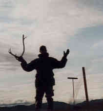
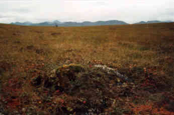
13 August, 1998August 13, 1998 Imnavait Creek Site, Entering Data Today we got our first taste of actual research in the field. We went to Imnavait Creek and learned how to probe active layer depth. The active layer is the seasonally frozen ground that is right above the permafrost. To measure its depth you need to shove a metal probe into the ground until you hit something very solid, then determine if it is a rock or the permafrost. When you hit the permafrost it gives a little, just like chipping ice. The active layer depth also varies quite a bit throughout the one kilometer square area we checked. Anywhere from 29 cm. to 110 cm. in places. The average depth of the active layer at Imnavait was 56.5 cm. Walking on the tundra is much different than walking anywhere else. The tussocks and other plants make moving in a straight line very difficult. I think it is like walking in a boulder field that is covered in varying thicknesses of foam padding. The foam padding of the tundra is the decayed and decaying organic material from centuries past. This peat is just like a sponge also. It soaks up incredible amounts of water and lets it loose when you step on it. I am really glad to have my rubber boots. Returning to the lab, we had to transfer the field data into a master log book and then enter it into the computer. This is the drudgery of the research. In the field, you get to move around and be active. In the lab you get to sit and get bogged down by large amounts of data. I definitely like the field better, even though every bone in my body seems to be aching. Tomorrow we will go to Happy Valley, but from the sound of it may not be the happiest place on earth (I hope Disney doesn't get too mad that I used their copyrighted slogan - that would really infuriate the duck). MYM JAVIER'S PIECE My first experience of field work on the Northern Slope. Even though the valley where Imnavait was seemed small, the dimension of depth was very misleading. It took about 30 minutes to travel from one end of the grid to the other: and it's only a kilometer. At the very top of the grid, where I was, I could see for about five miles onto the next valley and river and across to the pipeline. Just the vastness and repetition of wildlife here was amazing. While I was up at my section of the grid, I found the one of the antlers from some female caribou. Nothing like this would ever be found near my home. In my measurements, I also realized that the active layer of the tundra at the river basin was far more uniform than the depth of the active layer at the slopes of the mountains. Tomorrow, we will go to Happy Valley and hopefully, I'll be able to take some pictures of a bear at great distances, for security reasons, of course.
Contact the TEA in the field at . If you cannot connect through your browser, copy the TEA's e-mail address in the "To:" line of your favorite e-mail package. |