|
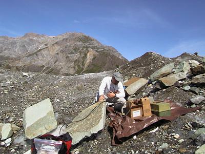
17 July, 1999July 17 Today there was much interest in monitoring the lake as it finished draining. While breakfasting at camp this morning, Bob Anderson (Geomorphologist from UC Santa Cruz) flew over in an airplane to take aerial photographs of the lake. Surveyor Dennis Trabant (USGS from Fairbanks) was up and at the surveying monument early. This is a critical stage for surveying. The glacier in the vicinity of the lake is going through significant topographic changes as the drain/flood continues. Dennis needs to capture these position changes in order to further understand the response of the floating portion of the glacier to the changing lake level. After breakfast I made my way up to the survey site. Dennis was surveying. PI Joe Walder reported from the lake that the level had dropped 30 meters (~100 feet) since yesterday morning. Little of the lake remained. Surface water was barely visible. Icebergs were stranded throughout the lake basin. The larger of these were breaking apart, generating loud rumblings. Booming noises filled the air as blocks of ice calved from the margin of the glacier and into the lake. Seismologist Steve Malone arrived to watch the show. "Oohs", and "Ahs", and "Whoa! Look at that", dribbled from our voices. The scene exceeded the best of any fireworks show I had ever observed. Grad student Don Lindsay and driller Joel Harper hiked out to the borehole to transfer data from the borehole pressure transducer to the computer. The data suggested that water level in the hole had come up during the night and had started to drop. It was too early to interpret what these data meant. Now that the drilling was finished, Joel Harper was going to head for home. This was his third project on a glacier this summer. He has had a long summer of work in the field. When I walked down from the survey site I saw him walk over the adjacent rise. He was hiking to the Foss airstrip, located about a mile and a half to the north of our camp. Seismologist Steve Malone is also leaving today. I will be monitoring his seismometers for the next few days. By the end of the day PI Andrew Fountain (Portland State University) was giddy - enthusiastic about the outcome of the project. No one had ever measured an outburst flood from the source to the discharge before. He thanked us all for our hard work. The early flooding inconvenienced the collection of an extensive data set. However, data from each of the aspects of the study was successfully collected. We stood around the camp table and raised our glasses (plastic cups actually - they did not "chink" very well at the tap of the rim) to a successful and eventful effort. _______________________________________________________________ Get Free Email and Do More On The Web. Visit http://www.msn.com
Contact the TEA in the field at . If you cannot connect through your browser, copy the TEA's e-mail address in the "To:" line of your favorite e-mail package. |