|
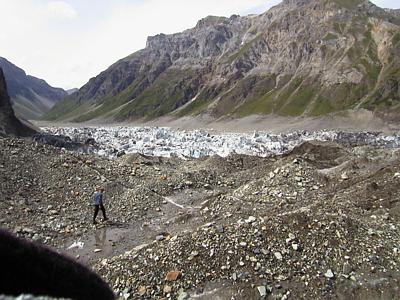
18 July, 1999July 18 I heard some loud rumbling from the vicinity of the lake at about 5:00 AM this morning. It sounded like some major calving and collapse of ice was occurring. When I checked the seismograph later in the day the seismic record confirmed what I had heard from my tent. The seismograph drum was literally black with inky wave patterns for a few hours which corresponded to the early morning. Most of the settling of the ice dam had occurred during the night. Don Lindsay (grad student) and I went out to the former drill site to download pressure transducer data from the data logger at the borehole. When first drilled, the hole had a water level of 22 meters. This means that water came into the drill hole up to a point 22 meters below the surface of the ice. Today the 147-meter deep hole was empty. Fresh fractures ran throughout the former drill site. The pool of water that had been used as a source of drilling water was empty. A huge, gaping cavern that extended down into the ice is what remained. Not only had the lake drained, but all of the water which had permeated cracks and crevasses in the glacier near the lake had also drained. PI Andrew Fountain was fascinated by these observations. The hydraulics of the glacier were complex. We decided to return tomorrow with the borehole camera to shoot more video of the hole. On the way to the drill site we noticed numerous fresh fractures in the ice. The sound of "popping" ice - a cracking, deep-seated, low percussive sound - reminded us that the ice dam/glacier had not completely stabilized since the drain of the lake. We made our way to the opposite side of the ice dam and looked down more closely onto the former lake. Huge, stranded icebergs mottled the lake bed. Large fractures ran through the ice dam adjacent to the former lake. The ice dam, which had obviously been floating a day ago on the former lake, had collapsed significantly - 100 meters or so. There was not much to say. Don and I gazed and listened in awe. The degree of change to the surface topography of the glacier in the vicinity of the lake was impressive. On the way back to camp we passed PI Andrew Fountain and St. Olaf undergraduate student Andrew Malm. They were running ice radar lines across the glacier. Andrew was interested in learning as much as he could about the topography of the glacier bed in the vicinity of the lake. Decisions have been made about how much longer we will be in the field. The helicopter is available Thursday afternoon the 22nd. That is when our gear will be sling-loaded out of here. That is when we will depart the field site. _______________________________________________________________ Get Free Email and Do More On The Web. Visit http://www.msn.com
Contact the TEA in the field at . If you cannot connect through your browser, copy the TEA's e-mail address in the "To:" line of your favorite e-mail package. |