
 | |||||||||||||||
|
|
Journals 2009/2010David Wehunt
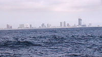
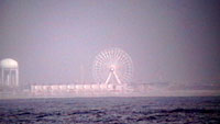
August 22, 2009 Latitude: N 40° 17' 75" What a day! We started our watch off the coast of New Jersey doing a water collection station for the NASA researchers using the rosette with its Nansen bottles. Then we moved up the coast to one mile opposite Atlantic City, NJ. We were so close, the city was visible through the fog. We could even see the Ferris wheel.
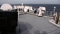
After collecting more water and doing our bongo tow we moved on. By the end of our watch we had worked a total of 6 stations. One thing that helped was the end of the heat wave. We have a front on the coast to our left and Hurricane Bill moving up fast on our right so lots of cloud cover today. Even so I am beat. Speaking of Hurricane Bill, the swells have gotten bigger. They are now getting up to 8 feet in height. The up and down rocking motion as we go forward through the waves doesn't bother me but the side to side rocking is like constantly walking up and down hills; very tiring. Also it makes opening and closing the heavy sea doors a lot more work. Below is a photo that I hope gives some idea of the wave action.
We have been watching Hurricane Bill very closely. Originally we needed to know where it was going to see if our paths intersected; they didn't. Next we needed to know how big the swells would get because there is a limit to how high they get (10 feet) before we can't work our stations. So far they have not been a problem but tomorrow we will be moving out to sea into the back side of Hurricane Bill and because of the fetch off shore, the swells may be considerably higher than today. We will see what happens tomorrow. Tomorrow I will talk about the team I work on. Later I will focus on the crew and if possible, the other scientists on board. That's all today as I am headed for bed. |
||||||||||||||


