| |||||||||||||||||
|
|
Journals 2007/2008Mark Goldner
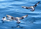
November 29, 2007 56° 27' S, 61° 17' W Another beautiful Spring day in the Drake! This morning I was awakened by a hurried scampering outside my cabin door; upon hearing someone say "whales," I bolted out of bed and rushed up to the bridge. I got up there just in time to see several whales spouting off the stern (Fin Whales most likely, according to Brandon, the First Mate). Once again, they were too far off to get photographs. I did get some more pictures of birds, though!
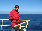
This morning it was warm, sunny and with very little wind. It was wonderful to spend the first couple hours of my day standing out on the catwalk outside the bridge watching the water and birds, soaking up the spring sunshine.
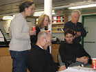
This evening the good weather seems to have finally gone away. It suddenly clouded up, and we are in a thick "pea soup" fog. The forecast is for rainier and windier weather for the next few days. We are slowly progressing through the CPIES sites doing CTD casts. It's a very slow process. Meanwhile the science team is involved with monitoring all the CTD casts and communicating with the CPIES to make sure they are collecting data properly.
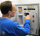
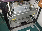
I've been doing another important measurement, which makes me feel useful. (My 8th grade students should be interested in this, given the experiments you began before I left.) During the CTD cast, a measurement of salinity and temperature is taken at 6 different depths, between the surface and the sea floor. The measurement of salinity is critical and the oceanographers need to know this value precisely. So in addition to a direct measurement on the CTD package, actual water samples are collected at each depth so the salinity can be measured again back on board the ship. The way the samples are collected is pretty cool. Large bottles, called Niskin bottles are attached to the CTD - they have an open stopper on each end so water can flow through them. When the CTD package reaches the desired depth, a signal is sent along a cable for one of the bottles to close, collecting a bottle-sized sample of the water at that depth. So I've been involved in measuring the salinity of the water samples using an instrument called a "salinometer." The idea behind the device is pretty simple; the amount of conductivity (how well the water conducts electricity) in the water is measured using electrodes (I think it's applying a voltage and measuring the associated current, but I can't seem to find anyone on board who knows for sure, and user's manual seems to be missing!). It turns out that the amount of salt in the water is directly proportional to the conductivity. The measurement itself isn't terribly difficult or exciting, but it's nice to feel that I'm contributing some small amount of data to the overall effort. Five years or so when the final results of this study are published, I'll know that I had a tiny but perhaps important role to play.
I've been discovering how many interesting things this ship can do and measure. As I mentioned in earlier posts, I've been involve in a "Sonar Multi-beam" mapping project that is always ongoing on this ship. The ship is equipped with a "multi-beam" device that sends out sound (sonar) signals that bounce off the sea floor. The return signals are used to create very accurate maps of the sea floor. I've been involved in looking over the data to weed out data that might be bad. Again, it's nice to know that I've contributed in some small way to the mapping of the sea floor; in some areas to sections that have never been mapped before! I also discovered tonight that this ship is equipped with a very sensitive gravity meter. Again, as the ship chugs along, it is constantly monitoring subtle changes in the amount of gravity due to changes in the Earth's structure on and deep below the sea floor. It turns out that what we learn about the Earth's gravity being 9.8 m/s^2 is really an average value - if you go to a tall mountain, you might find that the gravity is greater because of the extra mass below you. And, above a deep undersea trench, you might find that gravity is lower. In fact it turns out that there are very large measurable changes in the sea surface level all over the ocean as a result of these changes in gravity. The amount of gravity also changes depending on your latitude. Turns out that there is less gravity on the equator than at the poles, due to the spinning "centrifugal force" being greater at the equator. (I guess I weigh a little more here at 56 degrees latitude than I would back home at 42 degrees latitude!) So measuring the specific amount of gravity is really important for all sorts of projects, and the ship just records the data as it goes along. The way the instrument works is again based on a simple principle - a beam resting on a spring. As the amount of gravity increases, the spring gets compressed. The challenge, of course, is how to keep such a device level as the ship moves all over the place. So the instrument rests on a set of sensitive shock absorbers and its position is kept level using devices called "fiber optic gyroscopes". Pretty darn cool, I'd say; to be able to keep a constant and extremely accurate record of the exact amount of gravity on a moving ship!
|
||||||||||||||||