| |||||||||
|
|
Journals 2007/2008Megan O'Neill
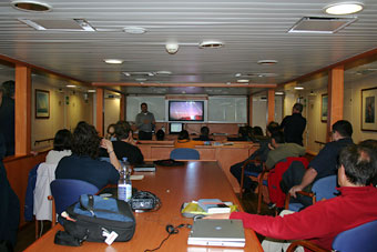
August 12, 2007 Today was definitely a day for whale watching. The seas are so calm it is like a lake - a super large lake! The seismics ended last night and now we are just covering areas of the sea floor not filled in with the multibeam and Topas. Our location is 75°28'N and 14°26'E with a heading of 318 degrees N, speed of 9.4 knots and depth of 389 m. We are in much shallower waters because we are along the slope mapping this area. This afternoon I saw about 10 white beaked dolphins that were right next to the ship. It was amazing because they were so close you could see the white markings on them. You could also see what we think was a fin whale in the distance surfacing. It seemed enormous. Angelo caught a video of the sperm whale that was near the ship several days ago that I cannot wait to share with my students. I also have many pictures, but will have to upload them when I return because our connection to send and receive e-mail cannot handle large files. José Abel gave a presentation today on his work, which was extremely interesting. He has been working in Antarctica for a few years looking at two study areas. The geological time periods that he has focused on are the Pleistocene for climate changes and Pliocene for asteroid impacts. He has been fortunate enough to have been on the JOIDES Resolution Research Vessel a few times to collect sediment samples to evaluate. He described the ship, which is owned by the U.S. and the Ocean Drilling Program. It is 200 m in length and has a drilling rig in the center. It is able to drill down up to 5 km in water and 3-4 km in the ocean floor! Fascinating! He also described the thrusters that are located on all four corners that maintain its position while drilling through GPS settings. With the climate changes in the earth's past, he looks for patterns over time with micropaleontology. In particular, he focuses on coccolithophores. Based on the types and sizes, they can estimate interglacial or glacial periods. They have also focused on an area that was discovered to have had an asteroid impact approximately 2.5 million years ago between Antarctica and Southwest Chile. The soil samples have indicated that there was a severe mixing of the sediments at this time. There have been other pieces to the puzzle such as whale fossils in the tops of the Andes at this time period, which may have been a result of the impact of the wave from the ocean that was estimated to be up to 65 m in height!! Wow- just imagine! There are other supporting pieces such as the Iridium found in sediment layers that indicate the asteroid impact and changes in the coccolithophores. The name associated with the asteroid came from the U.S. ship that did research in the 1950's and 60's on it, the Eltanin. It is incredible to think about studying these things on the bottom of the ocean that are so visible on land and having to piece together the puzzle of it all underneath the water! Now connecting Marine Science with Space Science! He also told us about an asteroid that has been studied, de Apofis, which scientists indicate is on course for possible impact with the Earth by the year 2029 or 2036 and he showed a certificate for "Asteroid Insurance" by Matt Lauer and Katie Couric from the Today Show - we will we need this on top of our "hurricane insurance" along the Gulf Coast in the future?!
|
||||||||