
 | |||||||||||||||||||
|
|
Journals 2009/2010Aundrea Rue
July 30, 2009
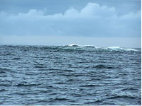
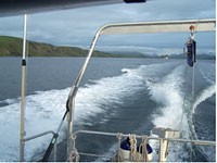
The actual hydrography got underway today. I went out on launch #4 (a 7-ton research vessel) to survey the waters around Poperechnoi Island. The survey involved measuring water depth, conductivity/temperature/depth to determine sound speed through the water, and bathymetrical features, as well as double-checking information from existing nautical charts. Multi-beam sonar was used to measure water depth and identify any notable structures present in the water. An example of a notable feature that we came across was a rock awash, which means a rock that's only visible at mean lower low water or less. When I first saw it in the distance I thought I was observing a small whale splashing around, but as we got closer I found that what I was actually seeing were the whitecaps of the waves that were crashing over it.
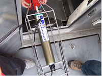
We used a Seabird CTD to acquire the conductivity, temperature and depth of the water. It is important to have this information because they all affect the speed at which sound waves, in this case, sonar, travels through water. This will have a direct affect on how accurately the multi-beam sonar can measure the water depth.
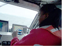
I got to drive the launch, take data and rescue a "man overboard" that was really a buoy, used in a man-overboard drill. What a great day. And, as a late birthday present, I saw puffins (Horned & Tufted) as well as SEVERAL humpback whales! And, as the perfect end to the day, one of the survey technicians took me and two other visiting scientists kayaking around Dolgoi Island where we're anchored. There were beautiful waterfalls, lots of sea grass, as well as nesting puffins and resting harbor seals on and around a nearby sea stack! It's absolutely gorgeous here! Tomorrow I'm going out to do seafloor bottom sampling. Stay tuned for more as my trip progresses!
|
||||||||||||||||||
