
 | |||||||||||||||||||||||
|
|
Journals 2008/2009Steve Howard
August 26, 2008
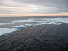
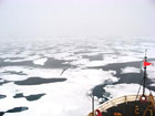
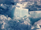
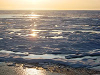
When you're out on the Arctic Ocean, you are constantly aware of the state of the ice all around you. Every place on the ship affords a commanding view, and after a few weeks I notice that I am now able to distinguish much more subtle differences in the condition of the ice than I had when I first got on board. Differences in thickness, color, transparency, whether the ice is pitted with holes or solid, the cover of snow on top, the size of the floes, how spread apart they are... it is always fascinating to watch the variety. Within a day's time, we might have every condition from open water to thin sheets of ice called "nilas" to 6 foot thick ice floes that we have to back up and ram repeatedly to get through.
One major misconception that I had was that the thickest part of the Arctic Ice Cap was centered on the North Pole. I see now that the ice coverage up here is very dynamic, with wind and water currents pushing the floes around the Arctic Ocean basin like flakes in a cereal bowl. Currently, the thickest ice is not centered on the Pole, but closer to the northern coast of Greenland and the Canadian Archipelago. I suspect everyone reading this has heard about the increasing alarms being sounded concerning shrinking Arctic ice coverage. We have a team of scientists from the US National/Naval Ice Center on board the Healy, led by scientist Pablo Clemente-Colón. They are gathering observational data during the cruise on sea ice types, percent of ice coverage, and the melting process, as well as deploying specialized ice buoys and open ocean drifters, which will add to and help validate the current database on Arctic Ocean ice conditions gathered from existing buoys, satellites, aircraft, and other ships. As Pablo shared in a science talk with us this evening, the data they have been collecting make it increasingly clear that the Arctic sea ice is retreating faster than previous climate change models had predicted, a consequence of an overall warming of the Arctic at twice the global rate in combination with other atmospheric and oceanic processes. Shrinking Arctic ice coverage may indeed be reaching a dangerous "tipping point", especially based on data over the last 5 years. The multi-year ice, the older and thicker part of the sea ice pack, has been hit especially hard, with ice that is much younger and thinner found covering less than half of the area it covered 30 years ago. Anomalous weather patterns, perhaps associated with other global changes, have helped blow a lot of this ice out of the Arctic Basin and into the Atlantic Ocean, where it drifts southward and eventually melts. In addition, melting ice produces darker "ponds" of water on top of older ice. As sea ice retreats, larger areas of open water are also exposed. Since ponds and open water are darker in color, they absorb more sunlight than the surrounding ice heating up more and speeding the melting process in a positive feedback loop. That is, the more exposed water there is, the more heating and melting occurs creating even more exposed water, and so on. This is called the "albedo feedback effect."
Its one thing to read about this stuff in books and hear it on TV. It's quite another to see this beautiful place in person and wonder what it will be like twenty or even ten years from now. Will there be any old ice left at all? What will happen to the animals that rely on thick ice pack to hunt and breed as they struggle to adjust to the rapidly changing conditions up here? It's tempting to think of the Arctic as a perpetually frozen and static place, but I can witness now that it is a dynamic and fragile system at risk. Perhaps I will get the opportunity to return here some day and see for myself what the future (and human actions) holds for the Arctic.
|
||||||||||||||||||||||

