


Connect to the TEA Streaming Audio Web Page
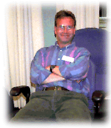
Steve is a science teacher at Lincoln High School in Wisconsin Rapids where he teaches Chemistry and Physics. He was one of four TEA teachers to Antarctica in 1995. He parcticipated in a six week research cruise aboard the N.B. Palmer in the Bransfield Strait along the Antarctic Peninsula. Future excursions to Antarc tica are not on the immediate horizon, but he would jump at the opportunity to visit the ice again. For him it was an experience that changed him as a teacher, husband, friend and person. The ice changes people.
Steve has a wife and young son who keeps them both very busy. Steve and his family enjoy traveling and summer and winter recreational activities like snow skiing and bicycling. Their family also includes a Border Collie who loves to herd their son. Future excursions to Antarctica are not in the near future, but he would love to go!
In addition to his teaching duties, Steve also is the boys and girls cross country coach and helps in the spring with boys and girls track. He is also involved with the schools computer committee and manages the public and science areas of the schools web page.
His background was originally in Biology. He is currently working to complete a Masters degree in Physics and has completed the undergraduate requirements for a major in Chemistry. He tries to maintain a balance between family and his teaching vocation, although summers are filled with classes and conferences.
Steve is a member of the GLACIER curriculum development team and is also the Teacher facilitator for the teachers going to Antarctica.
Neotectonic Structure of Terror Rift, Western Ross Sea
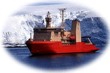
Aboard the Research Vessel Nathaniel B. Palmer
Principal Investigators: Dr. Terry Wilson, Ohio State University, and Dr. Lawrence Lawver, University of Texas-Austin
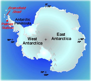
The experiments conducted on the cruise will be used to identify the boundary between East and West Antarctica along the Terror Rift in the western
Ross Sea. Using data gathered during this cruise and from data collected using airplanes, the researchers will map the fault patterns and volcanic
structures in this area. We will also map the orientations of volcanic fissures, vents, and seamount on the seafloor in the Ross Sea.
During the cruise they will then carry out multibeam sonar mapping of selected portions of the seafloor and use these data to map the orientations and
forms of volcanic bodies and the extent and geometry of neotectonic faulting associated with the Terror Rift.
The goals of the research are to:
- complete a map of faults and volcanic structures in the Terror Rift,
- interpret the structural pattern to derive the motions and stresses associated with the development of the rift,
- compare rift structures with faults and lineaments mapped in the Transantarctic Mountains to improve age constraints on the structures, and
A survey of whales in the Ross Sea will also be conducted as a collaborative effort with researchers from other universities conducting long term
studies of whale populations and migrations.
Polar Classroom Activities:
Seeing
the Seafloor Using Sound - Multibeam Sidescan Sonar
Connecting to the Poles through TEA E-Mail